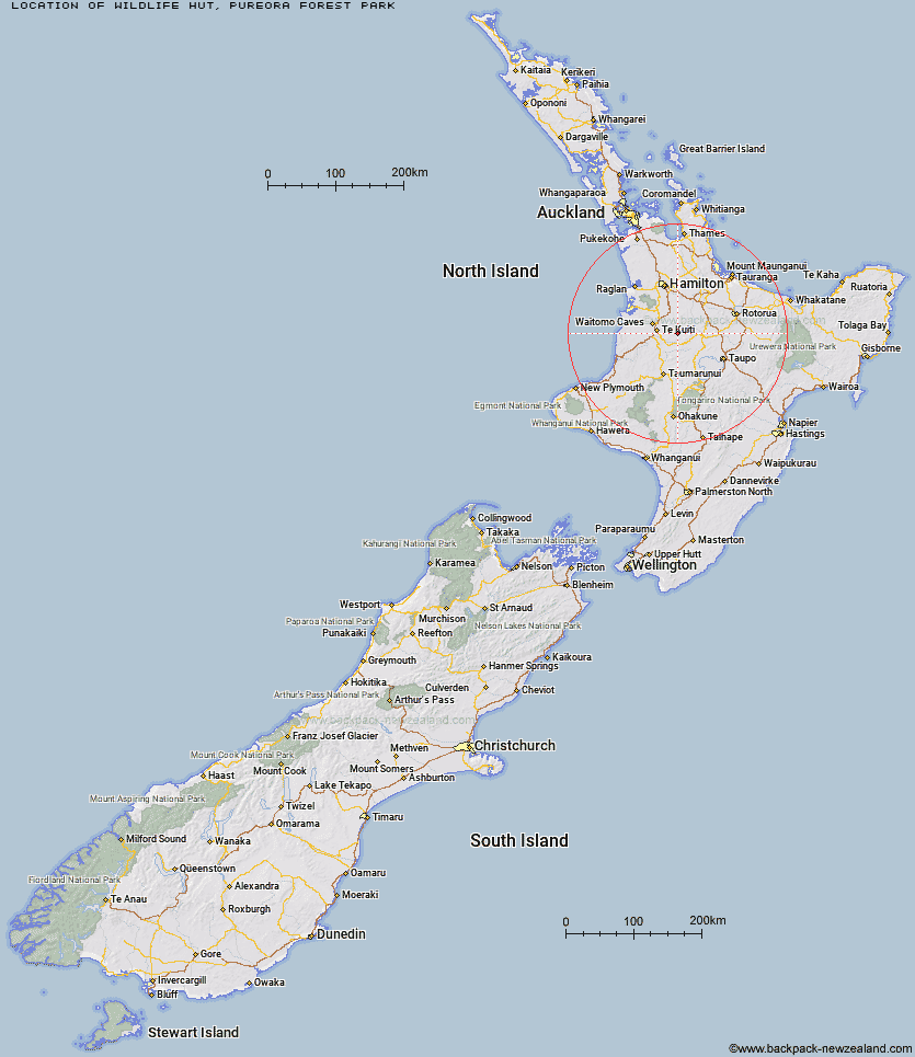
Topo Map showing location of Wildlife Hut
This information is sourced from DoC, LINZ and Openstreetmap. Some of the hut photos are mine and the rest are from DoC. I will be adding an upload feature soon so people can photos of .Wildlife Hut.
Basic info: basic four-bunk hut in the Waitomo/Pureora region.
Latitude: -38.376778544
Longitude: 175.451231623
Location: Pureora Forest Park
Area: Waikato
Type of Hut: Basic/bivvies
Map: BF34 Topo Map | Road Map
Does this hut still exist? Have any more information? Contact
Basic info: basic four-bunk hut in the Waitomo/Pureora region.
Latitude: -38.376778544
Longitude: 175.451231623
Location: Pureora Forest Park
Area: Waikato
Type of Hut: Basic/bivvies
Map: BF34 Topo Map | Road Map
Does this hut still exist? Have any more information? Contact
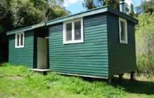
Image: DoC
Scroll down to see a topographical map and road map showing the location of Wildlife Hut
[ A ] [ B ] [ C ] [ D ] [ E ] [ F ] [ G ] [ H ] [ I ] [ J ] [ K ] [ L ] [ M ] [ N ] [ O ] [ P ] [ Q ] [ R ] [ S ] [ T ] [ U ] [ V ] [ W ] [ Y ] [ Z ]
Closest 20 Huts to Wildlife Hut
These are as the crow fliesBog Inn Hut 27.67km Hamilton Tomo Group Hut 33.8km Waihaha Hut 37.7km Hauhungaroa Hut 41.84km Pahautea Hut 52.94km Leitchs Hut 59.02km Ten Man Hut 71.16km Hurunui Hut 74.9km Mangamuka Hut 76.14km Ngamuwahine Shelter 78.09km Ketetahi Shelter 83.17km Ohuraiti Hut 83.61km Wairua Hut 86.18km Mangatepopo Hut 86.31km Kauritatahi Hut 86.91km Rerekapa Hut 88.68km Oturere Hut 89.36km Motutapere Hut 90.6km Waipakihi Hut 94km Te Rereatukahia Hut 94km Old Waihohonu Hut 94.54km Waihohonu Hut 94.69km Cascade Hut 94.97km Whakapapaiti Hut 95.9km Wairoa Shelter 98.7km Mangakino Shelter 99.38km Waitawheta Hut 99.56km Whangaehu Hut 101.41km WTFRW Hut 102.1km Mangaturuturu Hut 102.41km Daly's Clearing Hut 102.91km Rangipo Hut 103.75km Oamaru Hut 104.96km Poronui Hut 105.51km John Coull Hut 106.04km Blyth Hut 106.39km Lupton Hut 106.48km Red Hut 107.05km East Creek Hut 107.66km Mangaehuehu Hut 107.79km