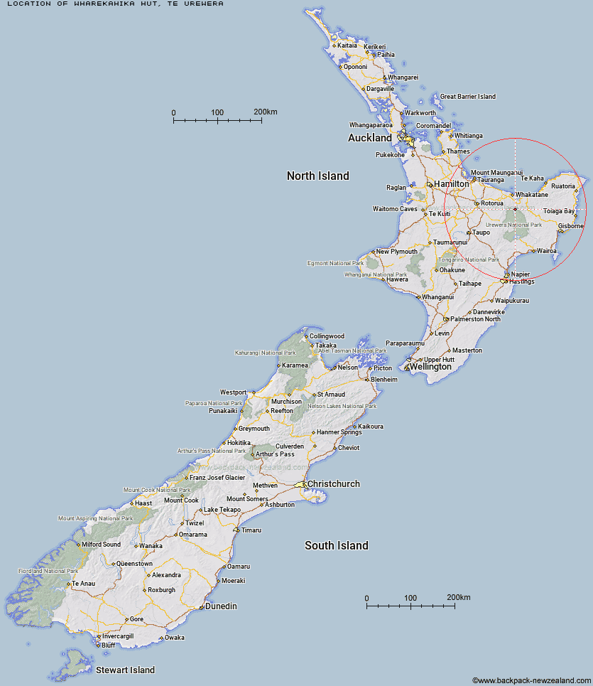
Topo Map showing location of Wharekahika Hut
This information is sourced from DoC, LINZ and Openstreetmap. Some of the hut photos are mine and the rest are from DoC. I will be adding an upload feature soon so people can photos of .Wharekahika Hut.
Basic info: basic six-bunk hut in the Te Urewera area.
Latitude: -38.2492865421
Longitude: 177.034734838
Location: Te Urewera
Area: East Coast
Type of Hut: Basic/bivvies
Tracks: Whakatane River area routes
Map: BF40 Topo Map | Road Map
Does this hut still exist? Have any more information? Contact
Basic info: basic six-bunk hut in the Te Urewera area.
Latitude: -38.2492865421
Longitude: 177.034734838
Location: Te Urewera
Area: East Coast
Type of Hut: Basic/bivvies
Tracks: Whakatane River area routes
Map: BF40 Topo Map | Road Map
Does this hut still exist? Have any more information? Contact
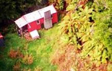
Image: DoC
Scroll down to see a topographical map and road map showing the location of Wharekahika Hut
[ A ] [ B ] [ C ] [ D ] [ E ] [ F ] [ G ] [ H ] [ I ] [ J ] [ K ] [ L ] [ M ] [ N ] [ O ] [ P ] [ Q ] [ R ] [ S ] [ T ] [ U ] [ V ] [ W ] [ Y ] [ Z ]
Closest 20 Huts to Wharekahika Hut
These are as the crow fliesApiti Hut 7.04km Ohora Hut 7.36km Twain (Waipotiki) Hut 7.39km Onepu Hut 8.55km Saddle (Mangaawai) Hut 8.75km Casino Hut 13.15km Waihua Hut 13.16km Mangamako Hut 15.64km Waikare Junction Hut 16.01km Koaunui Hut 16.36km Ohane Hut 16.69km Duckville Hut 18.55km Otapukawa Hut 18.78km Te Pourewa Hut 20.12km Manaohou Right Branch Hut 20.87km Hanamahihi Hut 21.14km Te Panaa Hut 24.1km Otane Hut 24.7km Nikau Flat Hut 25.24km Horomanga Base Camp 25.47km Te Pua Hut 25.81km Takurua Hut 25.82km Brills Bivouac 26.75km Otanetea Hut 26.88km Kotepato Hut 27.23km Ngahiramai Hut 27.48km Koranga Forks Hut 27.52km Tataweka Hut 28.19km Tawa Hut 28.57km Savlon Hut 29.39km Tawhiwhi Hut 29.51km Taurawharona Hut 29.96km Lagoon Hut 30.27km Tokenui Hut 30.74km Makakoere Hut 31.56km Hastings Hut 31.59km Makomako Hut 32.95km Mangatoatoa Hut 33.06km Kahunui Hut 33.2km Te Waiti Hut 33.43km