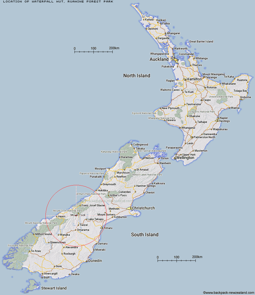
Topo Map showing location of Waterfall Hut
This information is sourced from DoC, LINZ and Openstreetmap. Some of the hut photos are mine and the rest are from DoC. I will be adding an upload feature soon so people can photos of .Waterfall Hut.
Basic info: standard six-bunk hut in the Manawatu region.
Latitude: -43.8334218396
Longitude: 169.989104754
Location: Ruahine Forest Park
Area: Manawatu/Whanganui
Type of Hut: Standard
Map: BK36 Topo Map | Road Map
Does this hut still exist? Have any more information? Contact
Basic info: standard six-bunk hut in the Manawatu region.
Latitude: -43.8334218396
Longitude: 169.989104754
Location: Ruahine Forest Park
Area: Manawatu/Whanganui
Type of Hut: Standard
Map: BK36 Topo Map | Road Map
Does this hut still exist? Have any more information? Contact
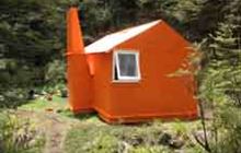
Image: DoC
Scroll down to see a topographical map and road map showing the location of Waterfall Hut
[ A ] [ B ] [ C ] [ D ] [ E ] [ F ] [ G ] [ H ] [ I ] [ J ] [ K ] [ L ] [ M ] [ N ] [ O ] [ P ] [ Q ] [ R ] [ S ] [ T ] [ U ] [ V ] [ W ] [ Y ] [ Z ]
Closest 20 Huts to Waterfall Hut
These are as the crow fliesReardon Hut 3.48km Kennedy Hut 5.57km Richardson Rock Bivouac 5.6km Erceg Hut 6.06km Barron Saddle Hut 8.33km Dodger Hut 11.24km Grough Hut 11.63km Mueller Hut 13.92km Harpers Rock Bivouac 14.17km Christmas Flat Hut 14.36km Whale Stream Hut 14.79km Station Hut 15.27km Cullers Hut 15.71km Elcho Hut 16.75km Jollie Hut 16.95km Horace Walker Hut 16.96km Lame Duck Hut 17.16km Stocking Stream Shelter 17.34km Sefton Bivvy 17.62km Dasler Bivouac 17.84km Stony Stream Bivouac 19.28km Douglas Rock Hut 20.19km Green Point Hut 20.67km Le Crens Hut 20.82km Copland Shelter 21.69km Red Hut 22.19km Welcome Flat Campsite 22.82km Welcome Flat Hut 22.84km Cassel Flat Hut 23.41km Littles Hut 24.56km Maryburn Hut 24.71km Monument Hut 25.5km Creswicke Flat Hut 26.04km Architect Creek Hut 26.05km Brodrick Hut 26.13km Caroline Hut 26.39km Main Huxley Forks Hut 27.59km Ball Hut 28.31km Empress Hut 28.61km South Huxley Bivouac 30.89km