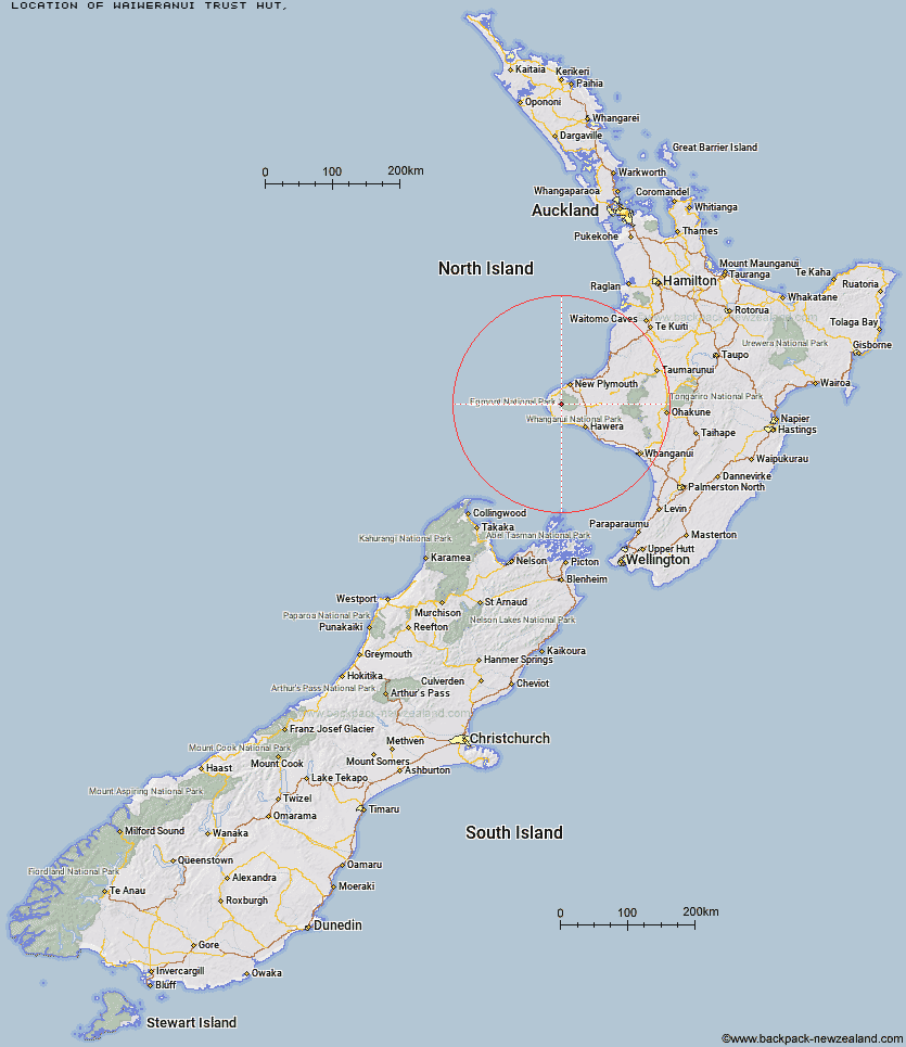
Topo Map showing location of Waiweranui Trust Hut
This information is sourced from DoC, LINZ and Openstreetmap. Some of the hut photos are mine and the rest are from DoC. I will be adding an upload feature soon so people can photos of .Waiweranui Trust Hut.
Latitude: -39.310134853
Longitude: 173.951320996
Location:
Type of Hut:
Map: Topo Map | Road Map
Does this hut still exist? Have any more information? Contact
Latitude: -39.310134853
Longitude: 173.951320996
Location:
Type of Hut:
Map: Topo Map | Road Map
Does this hut still exist? Have any more information? Contact
Scroll down to see a topographical map and road map showing the location of Waiweranui Trust Hut
[ A ] [ B ] [ C ] [ D ] [ E ] [ F ] [ G ] [ H ] [ I ] [ J ] [ K ] [ L ] [ M ] [ N ] [ O ] [ P ] [ Q ] [ R ] [ S ] [ T ] [ U ] [ V ] [ W ] [ Y ] [ Z ]
Closest 20 Huts to Waiweranui Trust Hut
These are as the crow fliesWaiweranui Trust Hut 0km Waiaua Gorge Hut 4.81km Kahui Hut 5.72km Holly Hut 9.69km Lake Dive Hut 9.84km Syme Hut 9.87km Pouakai Hut 11.16km Hooker Shelter 11.77km Maketawa Hut 13.1km Waingongoro Hut 13.72km Kaiauai Shelter 13.93km Trains Hut 69.52km Omaru Hut 71.16km Tahupo Hut 72.06km Puteore Hut 72.4km Pouri Hut 77.47km Rerekapa Hut 78.46km Ngapurua Hut 82.58km John Coull Hut 83.26km Puketotara Hut 88.29km Tieke Kainga 89.67km Ohuraiti Hut 97.81km Downes hut 111.31km Leitchs Hut 121.08km Ten Man Hut 133.07km Mangaturuturu Hut 133.41km Whakapapaiti Hut 135.07km Lupton Hut 135.15km Blyth Hut 135.39km Mangaehuehu Hut 137.56km Whangaehu Hut 140.92km Mangatepopo Hut 142.91km Rangipo Hut 143.91km Ketetahi Shelter 148.32km Old Waihohonu Hut 148.62km Hauhungaroa Hut 149km Waihohonu Hut 149.24km Oturere Hut 150.62km Hamilton Tomo Group Hut 153.49km Zekes Hut 156.35km