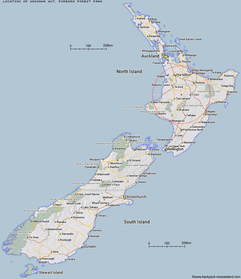
Topo Map showing location of Waihaha Hut
This information is sourced from DoC, LINZ and Openstreetmap. Some of the hut photos are mine and the rest are from DoC. I will be adding an upload feature soon so people can photos of .Waihaha Hut.
Basic info: standard 10-bunk hut in the Waitomo/Pureora area.
Latitude: -38.6950451726
Longitude: 175.600750113
Location: Pureora Forest Park
Area: Waikato
Type of Hut: Standard
Tracks: Pureora Forest Park tramping tracks
Map: BG34 Topo Map | Road Map
Does this hut still exist? Have any more information? Contact
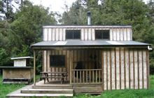
Image: DoC
Scroll down to see a topographical map and road map showing the location of Waihaha Hut
[ A ] [ B ] [ C ] [ D ] [ E ] [ F ] [ G ] [ H ] [ I ] [ J ] [ K ] [ L ] [ M ] [ N ] [ O ] [ P ] [ Q ] [ R ] [ S ] [ T ] [ U ] [ V ] [ W ] [ Y ] [ Z ]
Closest 20 Huts to Waihaha Hut
These are as the crow fliesHauhungaroa Hut 9.38km Bog Inn Hut 12.68km Wildlife Hut 37.7km Ten Man Hut 38.14km Ketetahi Shelter 46.14km Mangatepopo Hut 50km Oturere Hut 52.12km Waipakihi Hut 56.84km Old Waihohonu Hut 57.52km Waihohonu Hut 57.61km Cascade Hut 59.89km Whakapapaiti Hut 60.76km Ohuraiti Hut 63.14km Whangaehu Hut 65.33km Hamilton Tomo Group Hut 65.67km WTFRW Hut 66.35km Rangipo Hut 67.31km Mangaturuturu Hut 67.47km Blyth Hut 71.1km Lupton Hut 71.24km Oamaru Hut 71.36km Poronui Hut 72.13km Mangaehuehu Hut 72.2km Te Apunga Hut 72.95km Red Hut 73.9km East Creek Hut 74.15km Tussock Hut 74.59km Golden Hills Hut 75.6km Leitchs Hut 77.35km Mangatainoka Hut 78.04km Harkness Hut 78.39km Te Puke (Te Pukeohikarua) Hut 80.55km Rerekapa Hut 80.73km Bob's Hut 81.38km Ngaawapurua Hut 82.07km Otutu Island Hut 83.03km Tevers Hut 83.27km Ernie's Creek Hut 83.63km John Coull Hut 84.34km Otutu Hut 84.41km