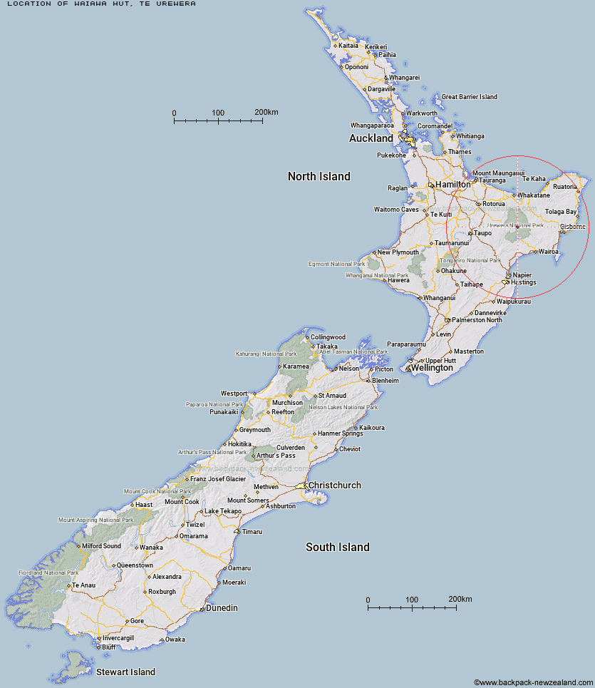
Topo Map showing location of Waiawa Hut
This information is sourced from DoC, LINZ and Openstreetmap. Some of the hut photos are mine and the rest are from DoC. I will be adding an upload feature soon so people can photos of .Waiawa Hut.
Basic info: standard eight-bunk hut in the Te Urewera area.
Latitude: -38.5650802769
Longitude: 177.047347843
Location: Te Urewera
Area: East Coast
Type of Hut: Standard
Map: BG40 Topo Map | Road Map
Does this hut still exist? Have any more information? Contact
Basic info: standard eight-bunk hut in the Te Urewera area.
Latitude: -38.5650802769
Longitude: 177.047347843
Location: Te Urewera
Area: East Coast
Type of Hut: Standard
Map: BG40 Topo Map | Road Map
Does this hut still exist? Have any more information? Contact
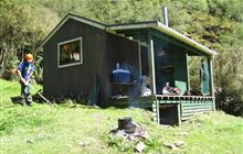
Image: DoC
Scroll down to see a topographical map and road map showing the location of Waiawa Hut
[ A ] [ B ] [ C ] [ D ] [ E ] [ F ] [ G ] [ H ] [ I ] [ J ] [ K ] [ L ] [ M ] [ N ] [ O ] [ P ] [ Q ] [ R ] [ S ] [ T ] [ U ] [ V ] [ W ] [ Y ] [ Z ]
Closest 20 Huts to Waiawa Hut
These are as the crow fliesKanohirua Hut 4.63km Taurawharona Hut 6.69km Tawhiwhi Hut 7.73km Makomako Hut 7.76km Otanetea Hut 8.3km Takurua Hut 10.05km Ngahiramai Hut 10.1km Mangatoatoa Hut 11.23km Manuoha Hut 11.96km Te Panaa Hut 12.57km Te Pua Hut 13.26km Te Rangaakapua Hut 14.48km Whakatakaa Hut 14.71km Hanamahihi Hut 16.88km Te Pourewa Hut 16.91km Otane Hut 17.31km Whanganui Hut 17.33km Ohane Hut 18.47km Mangapouri Hut 19.02km Tataweka Hut 19.1km Sandy Bay Hut 19.46km Waikare Junction Hut 19.73km Waiharuru Hut 19.89km Makakoere Hut 20.01km Manaohou Right Branch Hut 20.33km Otapukawa Hut 21.14km Kahunui Hut 22.11km Okui Hut 22.92km Marauiti Hut 22.96km Tawa Hut 23.75km Te Totara Hut 23.84km Horomanga Base Camp 25.73km Duckville Hut 26.86km Onepu Hut 27.03km Koaunui Hut 27.29km Waiopaoa Hut 27.51km Panekire Hut 27.52km Skips Hut (Whangatawhia) 27.57km Ohora Hut 28.02km Koranga Forks Hut 28.03km