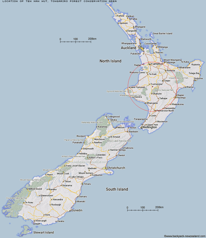
Topo Map showing location of Ten Man Hut
This information is sourced from DoC, LINZ and Openstreetmap. Some of the hut photos are mine and the rest are from DoC. I will be adding an upload feature soon so people can photos of .Ten Man Hut.
Basic info: basic 8-bunk hut in the Ruapehu area.
Latitude: -39.0166871073
Longitude: 175.447722303
Location: Tongariro Forest Conservation Area
Area: Central North Island
Type of Hut: Basic/bivvies
Map: BH34 Topo Map | Road Map
Does this hut still exist? Have any more information? Contact
Basic info: basic 8-bunk hut in the Ruapehu area.
Latitude: -39.0166871073
Longitude: 175.447722303
Location: Tongariro Forest Conservation Area
Area: Central North Island
Type of Hut: Basic/bivvies
Map: BH34 Topo Map | Road Map
Does this hut still exist? Have any more information? Contact
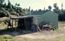
Image: DoC
Scroll down to see a topographical map and road map showing the location of Ten Man Hut
[ A ] [ B ] [ C ] [ D ] [ E ] [ F ] [ G ] [ H ] [ I ] [ J ] [ K ] [ L ] [ M ] [ N ] [ O ] [ P ] [ Q ] [ R ] [ S ] [ T ] [ U ] [ V ] [ W ] [ Y ] [ Z ]
Closest 20 Huts to Ten Man Hut
These are as the crow fliesMangatepopo Hut 19.18km Ketetahi Shelter 20.42km Whakapapaiti Hut 25.3km Oturere Hut 26.15km Old Waihohonu Hut 28.9km Waihohonu Hut 29.34km Hauhungaroa Hut 30.34km Mangaturuturu Hut 31.51km Whangaehu Hut 31.96km Rangipo Hut 34.98km Blyth Hut 35.67km Ohuraiti Hut 35.68km Lupton Hut 35.73km Mangaehuehu Hut 37.35km Waihaha Hut 38.14km Waipakihi Hut 45.66km Bog Inn Hut 50.7km John Coull Hut 52km Tieke Kainga 52.99km Puketotara Hut 54.95km Cascade Hut 57.6km Te Apunga Hut 59.76km Westlawn Hut 59.88km WTFRW Hut 60.06km Bob's Hut 60.17km Ngapurua Hut 60.92km Pouri Hut 62.58km Rerekapa Hut 63.48km Zekes Hut 63.71km Omaru Hut 65.04km Golden Hills Hut 65.19km Tussock Hut 68.29km Puteore Hut 68.95km Oamaru Hut 70.86km Harkness Hut 71.12km Wildlife Hut 71.16km Otutu Island Hut 71.82km Poronui Hut 72.03km Ngaawapurua Hut 73.23km East Creek Hut 73.35km