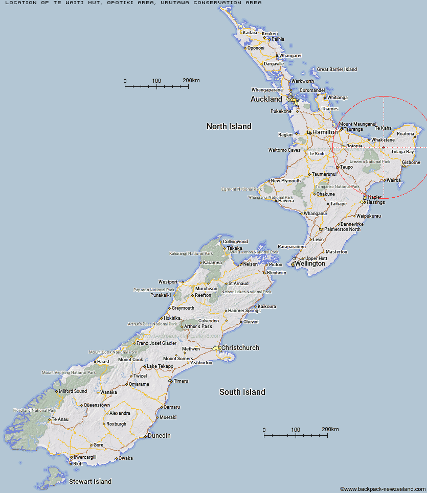
Topo Map showing location of Te Waiti Hut
This information is sourced from DoC, LINZ and Openstreetmap. Some of the hut photos are mine and the rest are from DoC. I will be adding an upload feature soon so people can photos of .Te Waiti Hut.
Basic info: standard six-bunk hut in the East Cape area.
Latitude: -38.1677353417
Longitude: 177.403006905
Location: Opotiki area, Urutawa Conservation Area
Area: East Coast
Type of Hut: Standard
Tracks: Te Waiti Hut Walk|Tokenui to Te Waiti Route
Map: BE41 Topo Map | Road Map
Does this hut still exist? Have any more information? Contact
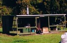
Image: DoC
Scroll down to see a topographical map and road map showing the location of Te Waiti Hut
[ A ] [ B ] [ C ] [ D ] [ E ] [ F ] [ G ] [ H ] [ I ] [ J ] [ K ] [ L ] [ M ] [ N ] [ O ] [ P ] [ Q ] [ R ] [ S ] [ T ] [ U ] [ V ] [ W ] [ Y ] [ Z ]
Closest 20 Huts to Te Waiti Hut
These are as the crow fliesLagoon Hut 3.52km Hastings Hut 4.69km Savlon Hut 5.24km Pakihi Hut 5.65km Wahaatua Hut 6.38km Brills Bivouac 6.75km Tokenui Hut 7.29km Pakihi Heads Hut 10.28km Manganuku Hut 11.92km Kotepato Hut 19.62km Nikau Flat Hut 23.07km Koranga Forks Hut 27.44km Koaunui Hut 27.54km Mangakirikiri Hut 29.58km Tawa Hut 32.02km Mangaotane Hut (McMillans) 33.38km Otapukawa Hut 33.4km Wharekahika Hut 33.43km Onepu Hut 34.17km Tataweka Hut 36.03km Kahunui Hut 36.39km Otane Hut 36.72km Makakoere Hut 37.05km Ohora Hut 37.36km Te Pourewa Hut 38.1km Apiti Hut 40.29km Twain (Waipotiki) Hut 40.59km Te Pua Hut 40.72km Ohane Hut 41.27km Te Panaa Hut 41.87km Saddle (Mangaawai) Hut 42.17km Waikare Junction Hut 42.85km Te Rangaakapua Hut 42.96km Mangatoatoa Hut 45.01km Casino Hut 46.13km Waihua Hut 46.58km Otanetea Hut 47.1km Taurawharona Hut 47.29km Makomako Hut 47.45km Hanamahihi Hut 48.49km