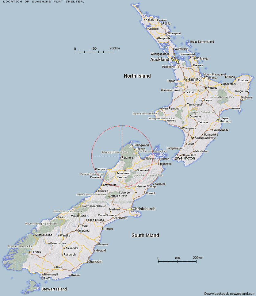
Topo Map showing location of Sunshine Flat Shelter
This information is sourced from DoC, LINZ and Openstreetmap. Some of the hut photos are mine and the rest are from DoC. I will be adding an upload feature soon so people can photos of .Sunshine Flat Shelter.
Latitude: -41.172418941
Longitude: 172.200821533
Location:
Type of Hut:
Map: Topo Map | Road Map
Does this hut still exist? Have any more information? Contact
Latitude: -41.172418941
Longitude: 172.200821533
Location:
Type of Hut:
Map: Topo Map | Road Map
Does this hut still exist? Have any more information? Contact
Scroll down to see a topographical map and road map showing the location of Sunshine Flat Shelter
[ A ] [ B ] [ C ] [ D ] [ E ] [ F ] [ G ] [ H ] [ I ] [ J ] [ K ] [ L ] [ M ] [ N ] [ O ] [ P ] [ Q ] [ R ] [ S ] [ T ] [ U ] [ V ] [ W ] [ Y ] [ Z ]
Closest 20 Huts to Sunshine Flat Shelter
These are as the crow fliesAdams Flat Hut 2.96km Greys Hut 9.71km Kohaihai Shelter 10.8km Katipo Creek Shelter 16.28km Roaring Lion Hut 19.69km Kākāpō Hut 19.76km Belltown Manunui Hut 19.95km Heaphy Hut 21.99km Wangapeka Bivouac 23.92km Venus Hut 25.62km Crow Hut 26.13km Stag Flat Shelter 26.14km Lewis Hut 26.22km Taipo Hut 26.79km Karamea Bend Hut 26.81km Thor Hut 28.2km Trevor Carter Hut 29.67km Cobb Hut 30.09km Helicopter Flat Hut 30.22km Fenella Hut 30.41km Tent Camp 30.49km James Mackay Hut 31.87km Chaffey Hut 32.16km Saxon Hut 33.06km Johnson Hut 33.4km Gouland Downs Hut 33.85km Stone Hut 34.04km Splugeons Rock Shelter 34.32km Flanagans Hut 34.47km Trilobite Hut 34.51km Perry Saddle Hut 34.6km Balloon Hut 35.29km Myttons Hut 35.47km Kiwi Saddle Hut 35.82km Lonely Lake Hut 36.63km Ministry of Works Historic Hut 36.79km Sylvester Hut 37.86km Soper Shelter 37.98km Adelaide Tarn Hut 38.45km Dry Rock Shelter 38.45km