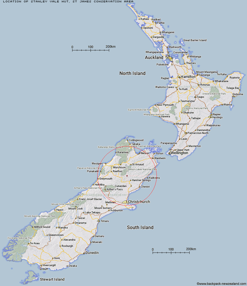
Topo Map showing location of Stanley Vale Hut
This information is sourced from DoC, LINZ and Openstreetmap. Some of the hut photos are mine and the rest are from DoC. I will be adding an upload feature soon so people can photos of .Stanley Vale Hut.
Basic info: Stanley Vale Hut is a basic six-bunk historic hut in the St James Conservation Area.
Latitude: -42.316097462
Longitude: 172.660313208
Location: St James Conservation Area
Area: Canterbury
Type of Hut: Basic/bivvies
Tracks: Stanley River Route
Map: BT24 Topo Map | Road Map
Does this hut still exist? Have any more information? Contact
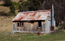
Image: DoC
Scroll down to see a topographical map and road map showing the location of Stanley Vale Hut
[ A ] [ B ] [ C ] [ D ] [ E ] [ F ] [ G ] [ H ] [ I ] [ J ] [ K ] [ L ] [ M ] [ N ] [ O ] [ P ] [ Q ] [ R ] [ S ] [ T ] [ U ] [ V ] [ W ] [ Y ] [ Z ]
Closest 20 Huts to Stanley Vale Hut
These are as the crow fliesLake Guyon Hut 3.37km Christopher Hut 8.42km Fowlers Hut 8.61km Christopher Cullers Hut 9.19km Pool Hut 9.6km Old Bridge Hut 9.82km Anne Hut 11.48km Anne Cullers Hut 12.61km Scotties Hut 12.75km Jervois Hut 12.95km East Matakitaki Hut 16.03km Stony Stream Bivouac 16.6km Ada Pass Hut 16.74km Bobs Hut 17.63km Caroline Creek Bivouac 18.07km Tin Jug Hut 18.09km Cannibal Gorge Hut 18.97km Steyning Hut 19km Rokeby Hut 20.79km Downie Hut 23.2km Island Gully Hut 23.29km Boyle Flat Hut 23.35km Upper D'Urville Hut 23.54km Paske Hut 24.03km Burn Creek Hut 24.83km Magdalen Hut 25.25km Tutu Hut 26.43km Pell Stream Hut 26.52km Yarra Hut 27.83km Sedgemere Sleepout 28.15km Lucretia Hut 28.43km Blue Lake Hut 28.67km Carlyle Hut 29.34km George Lyon Hut 30.21km Manson-Nicholls Memorial Hut 30.51km Brass Monkey Bivouac 30.53km Nardoo Hut 30.87km Nina Hut 32.38km Begley Hut 33.38km Upper Travers Hut 33.7km