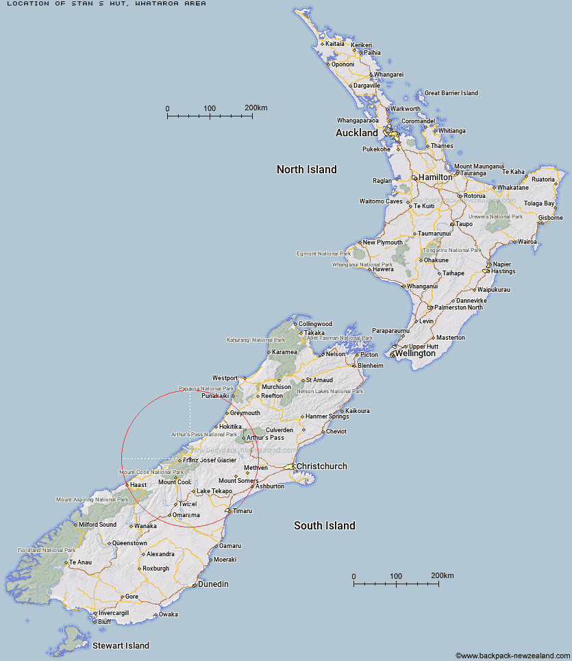
Topo Map showing location of Stan's Hut
This information is sourced from DoC, LINZ and Openstreetmap. Some of the hut photos are mine and the rest are from DoC. I will be adding an upload feature soon so people can photos of .Stan's Hut.
Basic info: standard four-bunk hut in the Glaciers area.
Latitude: -43.3554073822
Longitude: 170.402686294
Location: Whataroa area
Area: West Coast
Type of Hut: Standard
Map: BW16 Topo Map | Road Map
Does this hut still exist? Have any more information? Contact
Basic info: standard four-bunk hut in the Glaciers area.
Latitude: -43.3554073822
Longitude: 170.402686294
Location: Whataroa area
Area: West Coast
Type of Hut: Standard
Map: BW16 Topo Map | Road Map
Does this hut still exist? Have any more information? Contact
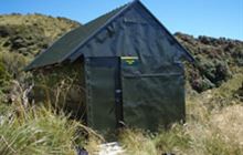
Image: DoC
Scroll down to see a topographical map and road map showing the location of Stan's Hut
[ A ] [ B ] [ C ] [ D ] [ E ] [ F ] [ G ] [ H ] [ I ] [ J ] [ K ] [ L ] [ M ] [ N ] [ O ] [ P ] [ Q ] [ R ] [ S ] [ T ] [ U ] [ V ] [ W ] [ Y ] [ Z ]
Closest 20 Huts to Stan's Hut
These are as the crow fliesButler Junction Hut 5.89km Nolans Hut 6.46km Top Butler Hut 7.84km Whymper Hut 9.95km Scone Hut 13.65km Spencer Rock Bivouac 14.04km Godley Hut 16.39km Murchison Hut 18.15km Tasman Saddle Hut 18.28km Kelman Hut 18.52km Eade Memorial Hut 19.32km Hende's Hut 20.12km Almer Hut 20.53km Centennial Hut 21.77km Castle Rocks Hut 21.92km Red Stag Hut 22.07km Forbes Bivouac 23.26km Saint Winifreds Hut 23.67km Murphys Bivvy 25.46km Mistake Flats Hut 25.68km Carneys Bivvy's 26.18km Pioneer Hut 26.41km Curtis Memorial Hut 27.25km Rankin Hut 28.08km Onslow Hut (Steffan Memorial Hut) 29.29km Chancellor Hut 29.34km Macaulay Hut 29.81km McCoy Hut 30.25km Haast Hut 30.26km Plateau Hut 30.91km Liebig Hut 31.29km Hunters Hut 31.7km Watchdog Hut 31.72km Growler Hut 32.18km Angus Hut 33.76km Ball Hut 34.48km Empress Hut 34.95km Scamper Torrent Hut 35.19km Memorial Hut 35.87km Birdcage Hut 36.3km