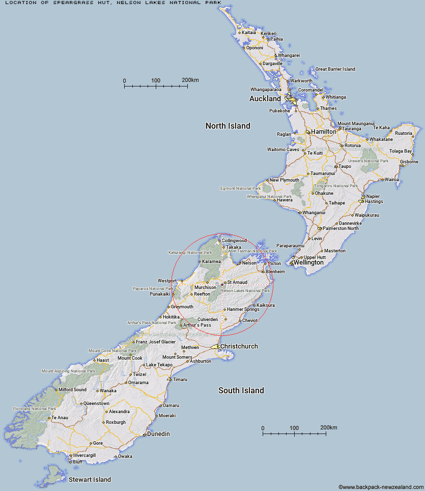
Topo Map showing location of Speargrass Hut
This information is sourced from DoC, LINZ and Openstreetmap. Some of the hut photos are mine and the rest are from DoC. I will be adding an upload feature soon so people can photos of .Speargrass Hut.
Basic info: Speargrass Hut provides an overnight tramp suitable for families with children or those new to tramping.
Latitude: -41.852021494
Longitude: 172.752384569
Location: Nelson Lakes National Park
Area: Nelson/Tasman
Type of Hut: Serviced
Tracks: Speargrass Track|Travers-Sabine Circuit
Map: BS24 Topo Map | Road Map
Does this hut still exist? Have any more information? Contact
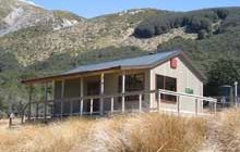
Image: DoC
Scroll down to see a topographical map and road map showing the location of Speargrass Hut
[ A ] [ B ] [ C ] [ D ] [ E ] [ F ] [ G ] [ H ] [ I ] [ J ] [ K ] [ L ] [ M ] [ N ] [ O ] [ P ] [ Q ] [ R ] [ S ] [ T ] [ U ] [ V ] [ W ] [ Y ] [ Z ]
Closest 20 Huts to Speargrass Hut
These are as the crow fliesAngelus Hut 4.06km Relax Shelter 5.07km Bushedge Shelter 5.35km Coldwater Hut 5.73km Bushline Hut 6.11km Lakehead Hut 6.34km Sabine Hut 8.03km Hopeless Hut 8.73km D'Urville Hut 10.62km Mount Misery Hut 11.37km Cupola Hut 13.43km John Tait Hut 13.71km Tiraumea Hut 15.43km Morgan Hut 17.67km West Sabine Hut 18.24km Upper Travers Hut 18.72km Mole Hut 19.25km Connors Creek Hut 20.29km Bull Paddock Creek Hut 20.31km Top Misery Hut 20.34km Begley Hut 20.61km Beebys Hut 20.92km Lees Creek Hut 21.02km Lost Stream Bivouac 22.6km Red Hills Hut 23.95km Blue Lake Hut 24.3km Mid Silverstream Hut 24.67km Silverstream Bivouac 24.86km George Lyon Hut 24.91km Bottom Misery Hut 25.48km Matakitaki Base Hut 26.5km Branch Bivouac 26.63km Siberia Hut 26.89km Paske Hut 28.86km Greigs Hut 29.28km Porters Creek Hut 29.99km Top Leatham Hut 30.42km Upper D'Urville Hut 30.97km Bottom Gordons Hut 33.1km Severn Hut 33.13km