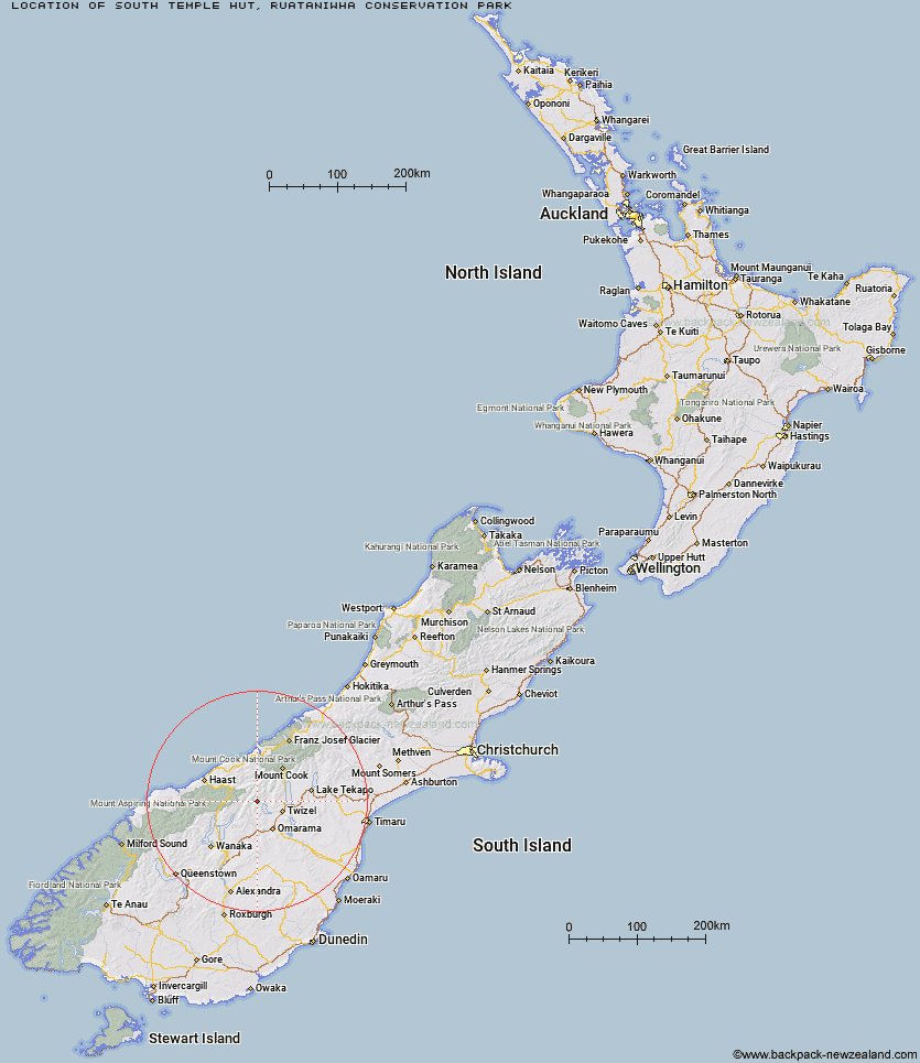
Topo Map showing location of South Temple Hut
This information is sourced from DoC, LINZ and Openstreetmap. Some of the hut photos are mine and the rest are from DoC. I will be adding an upload feature soon so people can photos of .South Temple Hut.
Basic info: standard six-bunk hut in the Mackenzie Country and Waitaki area.
Latitude: -44.1331217467
Longitude: 169.751046844
Location: Ruataniwha Conservation Park
Area: Canterbury
Type of Hut: Standard
Tracks: Temple valley tracks
Map: BZ14 Topo Map | Road Map
Does this hut still exist? Have any more information? Contact
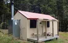
Image: DoC
Scroll down to see a topographical map and road map showing the location of South Temple Hut
[ A ] [ B ] [ C ] [ D ] [ E ] [ F ] [ G ] [ H ] [ I ] [ J ] [ K ] [ L ] [ M ] [ N ] [ O ] [ P ] [ Q ] [ R ] [ S ] [ T ] [ U ] [ V ] [ W ] [ Y ] [ Z ]
Closest 20 Huts to South Temple Hut
These are as the crow fliesTop Hut 6.97km Hagens Hut 9.23km Maitland Hut 9.31km South Huxley Bivouac 9.66km Monument Hut 13.07km Shamrock Hut 13.12km Main Huxley Forks Hut 13.98km Forbes Hut 14.06km Ferguson Hut 16.08km Red Hut 16.34km Snowy Gorge Hut 17.2km Bull Flat Hut 17.22km Brodrick Hut 17.67km Le Crens Hut 19.03km Ahuriri Base Hut 19.62km Scrubby Hut 19.7km Dasler Bivouac 21.07km Top Dingle Hut 22.58km Elcho Hut 23.32km Stony Stream Bivouac 23.59km Creswicke Flat Hut 23.88km Hideaway Hut 24.3km Cullers Hut 24.44km Station Hut 24.71km Makarora Hut 24.79km Baikie Hut 25.2km Wills Hut 25.39km Boundary Hut 25.64km Green Bush Hut 26.13km Little Boundary Hut 26.44km Grough Hut 27.16km Brewster Hut 27.51km Dodger Hut 28.28km Ben Avon Hut 28.57km Cotters Hut 31.53km High Burn Hut 31.91km Kennedy Hut 32.88km Whale Stream Hut 34.03km Erceg Hut 34.43km Cameron Hut 35.48km