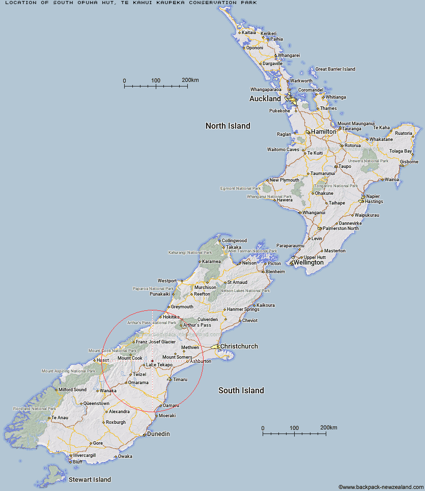
Topo Map showing location of South Opuha Hut
This information is sourced from DoC, LINZ and Openstreetmap. Some of the hut photos are mine and the rest are from DoC. I will be adding an upload feature soon so people can photos of .South Opuha Hut.
Basic info: standard six bunk hut in the Mid and South Canterbury area.
Latitude: -43.8917048731
Longitude: 170.72745832
Location: Te Kahui Kaupeka Conservation Park
Area: Canterbury
Type of Hut: Standard
Map: BY17 Topo Map | Road Map
Does this hut still exist? Have any more information? Contact
Basic info: standard six bunk hut in the Mid and South Canterbury area.
Latitude: -43.8917048731
Longitude: 170.72745832
Location: Te Kahui Kaupeka Conservation Park
Area: Canterbury
Type of Hut: Standard
Map: BY17 Topo Map | Road Map
Does this hut still exist? Have any more information? Contact
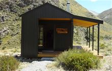
Image: DoC
Scroll down to see a topographical map and road map showing the location of South Opuha Hut
[ A ] [ B ] [ C ] [ D ] [ E ] [ F ] [ G ] [ H ] [ I ] [ J ] [ K ] [ L ] [ M ] [ N ] [ O ] [ P ] [ Q ] [ R ] [ S ] [ T ] [ U ] [ V ] [ W ] [ Y ] [ Z ]
Closest 20 Huts to South Opuha Hut
These are as the crow fliesCamp Stream Hut 12.56km Spurs Hut 13.65km Rex Simpson Hut 15.71km Royal Hut 18.45km Felt Hut 19.61km Devil's Creek Hut 21.32km Stone Hut 23.1km Sutherland's Hut 23.26km Ribbonwood Hut 24.88km Halfway Hut 25.35km Middle Gorge Hut 25.52km Taffy Hut 26.48km Stony Stream Hut 26.54km Ribbonwood Hut 27.05km Pleasant Gully Hut 28.93km Ryders Hut 29.1km Waterfall Hut 29.26km Crooked Spur Hut 30.2km Tin Hut 31.44km Bottom Mount Peel Hut 31.74km Top Mount Peel Huts 32.6km Telegraph Hut 33.15km Angus Hut 33.28km Dog Kennel Bivouac 34.86km Birdcage Hut 35.81km Macaulay Hut 36.01km Memorial Hut 36.4km Rankin Hut 38km Maryburn Hut 38.07km Black Mountain Hut 39.81km Littles Hut 40.48km Green Point Hut 40.72km Growler Hut 42.35km Jollie Hut 42.61km Red Stag Hut 43.07km Carneys Bivvy's 44.29km Liebig Hut 44.44km Eade Memorial Hut 45.87km Onslow Hut (Steffan Memorial Hut) 46.11km Murphys Bivvy 47.31km