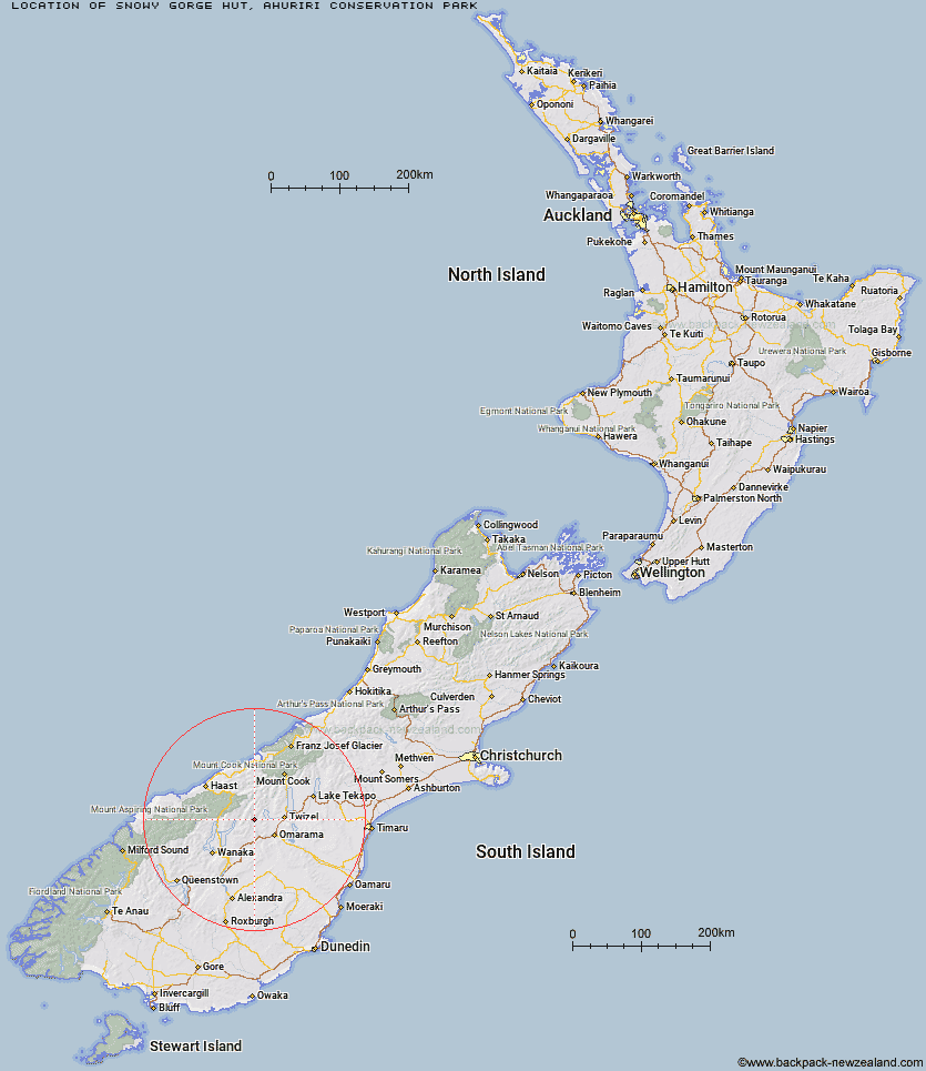
Topo Map showing location of Snowy Gorge Hut
This information is sourced from DoC, LINZ and Openstreetmap. Some of the hut photos are mine and the rest are from DoC. I will be adding an upload feature soon so people can photos of .Snowy Gorge Hut.
Basic info: basic five-bunk hut in the Mackenzie Country and Waitaki area.
Latitude: -44.2829654025
Longitude: 169.697688273
Location: Ahuriri Conservation Park
Area: Canterbury
Type of Hut: Basic/bivvies
Tracks: Snowy Gorge Creek - Maitland Stream
Map: BZ14 Topo Map | Road Map
Does this hut still exist? Have any more information? Contact
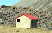
Image: DoC
Scroll down to see a topographical map and road map showing the location of Snowy Gorge Hut
[ A ] [ B ] [ C ] [ D ] [ E ] [ F ] [ G ] [ H ] [ I ] [ J ] [ K ] [ L ] [ M ] [ N ] [ O ] [ P ] [ Q ] [ R ] [ S ] [ T ] [ U ] [ V ] [ W ] [ Y ] [ Z ]
Closest 20 Huts to Snowy Gorge Hut
These are as the crow fliesHideaway Hut 7.12km Ahuriri Base Hut 7.93km Maitland Hut 8.21km Shamrock Hut 10.33km Top Dingle Hut 11.26km Ben Avon Hut 14.4km Hagens Hut 14.92km Cotters Hut 16.82km South Temple Hut 17.2km Top Hut 18.08km Green Bush Hut 18.18km Scrubby Hut 18.75km Bull Flat Hut 18.84km Boundary Hut 18.99km Little Boundary Hut 19.25km Ferguson Hut 21.64km High Burn Hut 21.77km Bush Hut 23.39km Top Timaru Hut 26.04km Mae West Bivouac 26.41km South Huxley Bivouac 26.53km Burnt Bush Hut 26.53km Makarora Hut 26.69km Forbes Hut 26.76km Big Hopwood Burn Hut 29.81km Monument Hut 30.2km Main Huxley Forks Hut 30.85km Brewster Hut 31.45km Cameron Hut 31.81km Wills Hut 33.06km Moonlight & Roses Hut 33.3km Red Hut 33.42km Brodrick Hut 34.33km Le Crens Hut 34.84km Baikie Hut 35.15km Stodys Hut 35.73km Junction Hut 37.79km Sawyer Burn Hut 38.02km Dasler Bivouac 38.2km Stony Stream Bivouac 38.47km