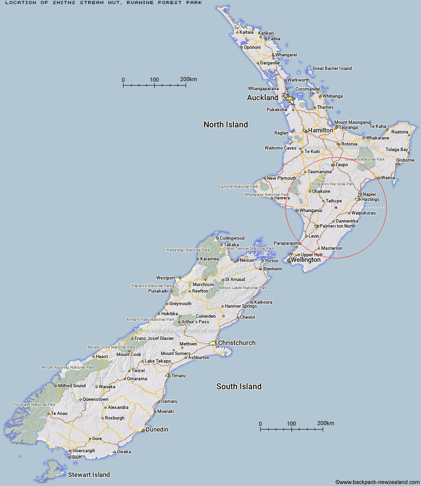
Topo Map showing location of Smiths Stream Hut
This information is sourced from DoC, LINZ and Openstreetmap. Some of the hut photos are mine and the rest are from DoC. I will be adding an upload feature soon so people can photos of .Smiths Stream Hut.
Basic info: standard four-bunk hut in the Hawke's Bay region.
Latitude: -39.8491632854
Longitude: 176.17042102
Location: Ruahine Forest Park
Area: Hawke's Bay
Type of Hut: Standard
Tracks: North Block Road tramping tracks
Map: BL36 Topo Map | Road Map
Does this hut still exist? Have any more information? Contact
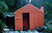
Image: DoC
Scroll down to see a topographical map and road map showing the location of Smiths Stream Hut
[ A ] [ B ] [ C ] [ D ] [ E ] [ F ] [ G ] [ H ] [ I ] [ J ] [ K ] [ L ] [ M ] [ N ] [ O ] [ P ] [ Q ] [ R ] [ S ] [ T ] [ U ] [ V ] [ W ] [ Y ] [ Z ]
Closest 20 Huts to Smiths Stream Hut
These are as the crow fliesSmiths Stream Hut 0km Hinerua Hut 1.4km Tarn Bivouac 4.44km Waikamaka Hut 5.22km Waterfall Hut 5.31km Waipawa Forks Hut 5.62km Triplex Hut 6.64km Sunrise Hut 6.86km Howletts Hut 7.2km Daphne Hut 7.46km Pourangaki Hut 7.72km Top Maropea Hut 8.37km McKinnon Hut 9.91km Gold Creek Hut 9.98km Kelly Knight Hut 10.01km Triangle Hut 10.16km Purity Hut 10.26km Norris Hut 10.67km Wakelings Hut 11.07km Crow Hut 11.69km Longview Hut 12.08km Sparrowhawk Bivouac 12.38km Iron Gate Hut 12.98km Maropea Forks Hut 13.55km Rangiwahia Hut 13.78km Awatere Hut 13.8km Top Gorge Hut 14.29km Kawhatau Base 14.73km Barlow Hut 15.4km Happy Daze Hut 16.64km Toka Bivouac 17.09km Alice Nash Memorial Heritage Lodge 17.55km Otukota Hut 17.71km Makaretu Hut 17.73km Ellis Hut 17.79km Poutaki Hut 18.27km Kylie Bivouac 19km Leon Kinvig Hut 19.01km Upper Makaroro Hut 19.44km Iron Bark Hut 19.77km