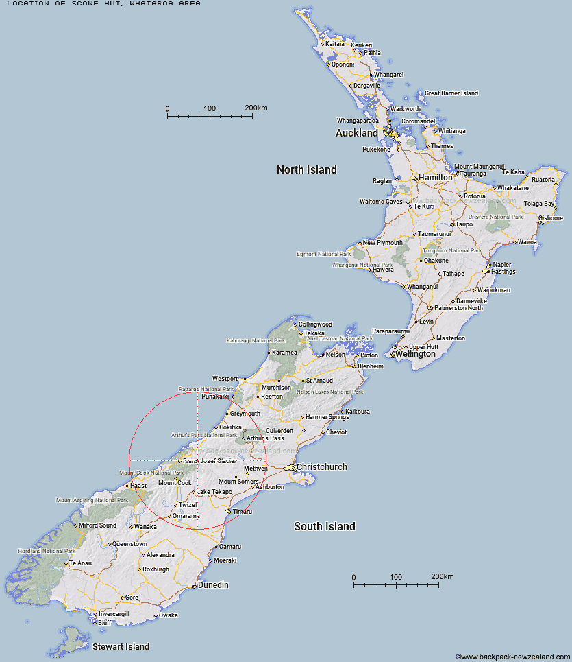
Topo Map showing location of Scone Hut
This information is sourced from DoC, LINZ and Openstreetmap. Some of the hut photos are mine and the rest are from DoC. I will be adding an upload feature soon so people can photos of .Scone Hut.
Basic info: standard six-bunk hut in the Glaciers area.
Latitude: -43.3757753247
Longitude: 170.569213965
Location: Whataroa area
Area: West Coast
Type of Hut: Standard
Tracks: Whataroa, Butler and Perth valleys tracks
Map: BW17 Topo Map | Road Map
Does this hut still exist? Have any more information? Contact
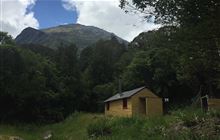
Image: DoC
Scroll down to see a topographical map and road map showing the location of Scone Hut
[ A ] [ B ] [ C ] [ D ] [ E ] [ F ] [ G ] [ H ] [ I ] [ J ] [ K ] [ L ] [ M ] [ N ] [ O ] [ P ] [ Q ] [ R ] [ S ] [ T ] [ U ] [ V ] [ W ] [ Y ] [ Z ]
Closest 20 Huts to Scone Hut
These are as the crow fliesScone Hut 0km Nolans Hut 7.67km Saint Winifreds Hut 10.28km Top Butler Hut 11.53km Forbes Bivouac 11.78km Godley Hut 12.56km Mistake Flats Hut 12.89km Butler Junction Hut 13.01km Murphys Bivvy 13.45km Stan's Hut 13.65km Curtis Memorial Hut 14.36km Carneys Bivvy's 15.36km McCoy Hut 16.68km Eade Memorial Hut 17.45km Whymper Hut 17.59km Watchdog Hut 18.07km Red Stag Hut 19.05km Growler Hut 20.33km Murchison Hut 21.24km Hunters Hut 22.23km Macaulay Hut 22.93km Kelman Hut 23.17km Tasman Saddle Hut 23.92km Erewhon Station Hut 23.93km Spencer Rock Bivouac 25.12km Lawrence Hut 26.01km Rankin Hut 26.3km Black Mountain Hut 27.34km Hermitage Hut 27.54km Scamper Torrent Hut 28.2km Lawrence Bivouac 28.48km Lyell Hut 28.82km Smyth Hut 29.26km Dog Kennel Bivouac 30.23km Kiwi Flat Hut 30.33km Centennial Hut 30.81km Almer Hut 31.13km Angus Hut 31.92km Hende's Hut 32.26km Moonbeam Hut 32.53km