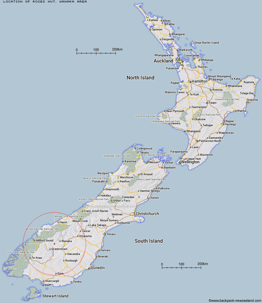
Topo Map showing location of Roses Hut
This information is sourced from DoC, LINZ and Openstreetmap. Some of the hut photos are mine and the rest are from DoC. I will be adding an upload feature soon so people can photos of .Roses Hut.
Basic info: standard 12-bunk hut in the Wanaka/Makarora area.
Latitude: -44.8044688692
Longitude: 168.862701251
Location: Wanaka area
Area: Otago
Type of Hut: Standard
Tracks: Motatapu Track
Map: CB11 Topo Map | Road Map
Does this hut still exist? Have any more information? Contact
Basic info: standard 12-bunk hut in the Wanaka/Makarora area.
Latitude: -44.8044688692
Longitude: 168.862701251
Location: Wanaka area
Area: Otago
Type of Hut: Standard
Tracks: Motatapu Track
Map: CB11 Topo Map | Road Map
Does this hut still exist? Have any more information? Contact
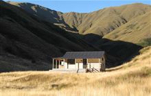
Image: DoC
Scroll down to see a topographical map and road map showing the location of Roses Hut
[ A ] [ B ] [ C ] [ D ] [ E ] [ F ] [ G ] [ H ] [ I ] [ J ] [ K ] [ L ] [ M ] [ N ] [ O ] [ P ] [ Q ] [ R ] [ S ] [ T ] [ U ] [ V ] [ W ] [ Y ] [ Z ]
Closest 20 Huts to Roses Hut
These are as the crow fliesHighland Creek Hut 7.09km Eight Mile Hut 9.44km Peats Hut 11.56km Fern Burn Hut 12km Cabin Hut 13.78km Bullendale Hut 15.04km Sainsburys Huts 15.6km Crystal Hut 15.67km Dynamo Hut 15.8km Shiel Burn Hut 17.01km Green Gate Huts 17.09km Ballarat Hut - Flood Burn 17.3km Polnoon Hut 17.68km Archie's Hut - Copper Creek 17.81km Saddle Hut 18.89km Meg Hut 19.67km Stoney Creek Hut 22.25km Sixteen Mile Huts 22.27km Black Peak Hut 23.12km Butchers Hut 23.51km Kirtle Burn Hut 24.63km Robrosa Hut 26.38km Deep Creek Hut 26.48km Hundred Mile Hut 27.11km Lochnagar Hut 30.12km Tummel Burn Hut 30.34km Wallers Hut 30.35km Kelly's Hut 30.69km Glen Roy Raceman's Hut 31.37km McIntosh Hut 32.19km Heather Jock Hut 32.57km Bonnie Jean Hut 33.17km McIntyre's Hut 33.2km Jean Hut 33.32km Raspberry Creek Shelter 33.66km Twenty Five Mile Hut 35.95km Wanaka Faces Hut 37.47km Sam Summers Hut 37.57km Cascade Hut 37.91km Earnslaw Hut 38.59km