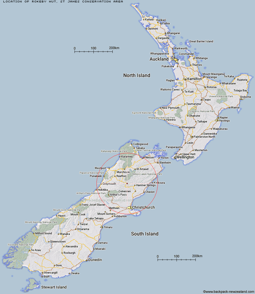
Topo Map showing location of Rokeby Hut
This information is sourced from DoC, LINZ and Openstreetmap. Some of the hut photos are mine and the rest are from DoC. I will be adding an upload feature soon so people can photos of .Rokeby Hut.
Basic info: basic three-bunk hut in the St James Conservation Area.
Latitude: -42.4336809515
Longitude: 172.463542108
Location: St James Conservation Area
Area: Canterbury
Type of Hut: Basic/bivvies
Tracks: St James Walkway
Map: BT23 Topo Map | Road Map
Does this hut still exist? Have any more information? Contact
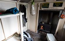
Image: DoC
Scroll down to see a topographical map and road map showing the location of Rokeby Hut
[ A ] [ B ] [ C ] [ D ] [ E ] [ F ] [ G ] [ H ] [ I ] [ J ] [ K ] [ L ] [ M ] [ N ] [ O ] [ P ] [ Q ] [ R ] [ S ] [ T ] [ U ] [ V ] [ W ] [ Y ] [ Z ]
Closest 20 Huts to Rokeby Hut
These are as the crow fliesRokeby Hut 0km Boyle Flat Hut 3.55km Magdalen Hut 7.13km Steyning Hut 8.7km Lucretia Hut 9.46km Jervois Hut 9.62km Anne Cullers Hut 9.73km Tin Jug Hut 9.76km Anne Hut 10.64km Nina Hut 12.14km Brass Monkey Bivouac 12.21km Cannibal Gorge Hut 12.22km Pool Hut 13.17km Carlyle Hut 13.24km Old Bridge Hut 13.29km Stony Stream Bivouac 13.94km Ada Pass Hut 14.37km Scotties Hut 14.49km Devils Den Bivouac 15.13km Pell Stream Hut 15.89km Upper Nina Bivouac 16.2km Lake Christabel Hut 17.1km Tutu Hut 17.48km Christopher Hut 18.17km Bus Shelter 18.29km Doubtful Hut 18.33km Christopher Cullers Hut 18.44km Manson-Nicholls Memorial Hut 20.23km Stanley Vale Hut 20.79km Doubtless Hut 21.81km Lake Guyon Hut 22.29km Lake Man Bivouac 23.39km Bobs Hut 23.42km Top Robinson Hut 23.84km Hope Halfway Hut 24.38km Saint Jacob's Hut 26.64km Museum Hut 27.72km East Matakitaki Hut 27.81km Valley Camp Hut 28.02km Fowlers Hut 28.14km