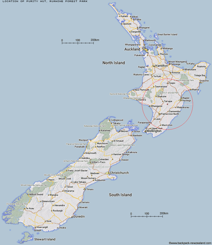
Topo Map showing location of Purity Hut
This information is sourced from DoC, LINZ and Openstreetmap. Some of the hut photos are mine and the rest are from DoC. I will be adding an upload feature soon so people can photos of .Purity Hut.
Basic info: standard six bunk hut in the Manawatu region.
Latitude: -39.820290368
Longitude: 176.056315448
Location: Ruahine Forest Park
Area: Manawatu/Whanganui
Type of Hut: Standard
Tracks: Purity Hut Track|Purity - Kelly Knight Hut Loop Track|Purity to Kawhatau Base Track
Map: BK36 Topo Map | Road Map
Does this hut still exist? Have any more information? Contact
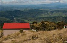
Image: DoC
Scroll down to see a topographical map and road map showing the location of Purity Hut
[ A ] [ B ] [ C ] [ D ] [ E ] [ F ] [ G ] [ H ] [ I ] [ J ] [ K ] [ L ] [ M ] [ N ] [ O ] [ P ] [ Q ] [ R ] [ S ] [ T ] [ U ] [ V ] [ W ] [ Y ] [ Z ]
Closest 20 Huts to Purity Hut
These are as the crow fliesKelly Knight Hut 3.33km Pourangaki Hut 4.75km Waterfall Hut 5.03km McKinnon Hut 5.41km Crow Hut 6.42km Waikamaka Hut 6.69km Kawhatau Base 6.78km Rangiwahia Hut 8.48km Triangle Hut 9.5km Wakelings Hut 9.63km Top Maropea Hut 10.08km Sunrise Hut 10.22km Smiths Stream Hut 10.26km Tarn Bivouac 10.28km Waipawa Forks Hut 10.43km Hinerua Hut 10.72km Howletts Hut 11.1km Iron Gate Hut 11.86km Maropea Forks Hut 12.27km Triplex Hut 12.48km Daphne Hut 12.77km Otukota Hut 13.22km Gold Creek Hut 13.68km Sparrowhawk Bivouac 13.93km Alice Nash Memorial Heritage Lodge 15.32km Longview Hut 15.63km Iron Bark Hut 15.72km Norris Hut 16.6km Top Gorge Hut 16.87km Barlow Hut 17.78km Colenso Hut 18.04km Awatere Hut 18.16km Toka Bivouac 18.16km Kylie Bivouac 19.85km Leon Kinvig Hut 20.51km Happy Daze Hut 20.96km Makaretu Hut 20.97km Upper Makaroro Hut 21.43km Ellis Hut 22.6km Parks Peak Hut 22.97km