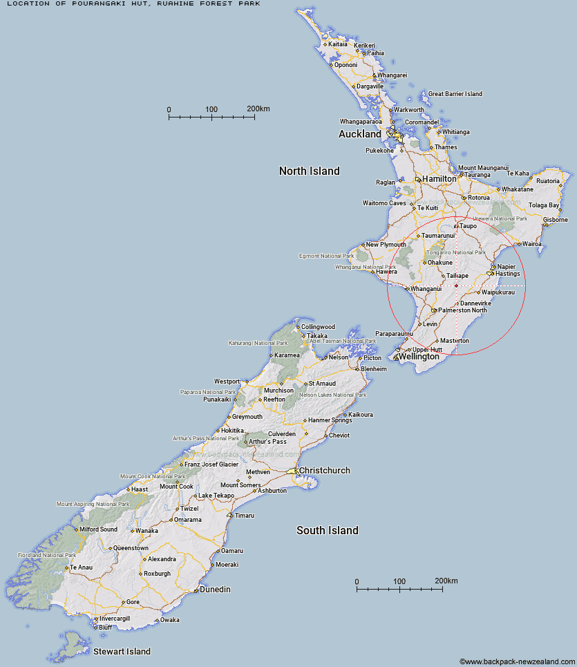
Topo Map showing location of Pourangaki Hut
This information is sourced from DoC, LINZ and Openstreetmap. Some of the hut photos are mine and the rest are from DoC. I will be adding an upload feature soon so people can photos of .Pourangaki Hut.
Basic info: standard eight-bunk hut in the Manawatu region.
Latitude: -39.858638982
Longitude: 176.080783918
Location: Ruahine Forest Park
Area: Manawatu/Whanganui
Type of Hut: Standard
Map: BL36 Topo Map | Road Map
Does this hut still exist? Have any more information? Contact
Basic info: standard eight-bunk hut in the Manawatu region.
Latitude: -39.858638982
Longitude: 176.080783918
Location: Ruahine Forest Park
Area: Manawatu/Whanganui
Type of Hut: Standard
Map: BL36 Topo Map | Road Map
Does this hut still exist? Have any more information? Contact
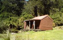
Image: DoC
Scroll down to see a topographical map and road map showing the location of Pourangaki Hut
[ A ] [ B ] [ C ] [ D ] [ E ] [ F ] [ G ] [ H ] [ I ] [ J ] [ K ] [ L ] [ M ] [ N ] [ O ] [ P ] [ Q ] [ R ] [ S ] [ T ] [ U ] [ V ] [ W ] [ Y ] [ Z ]
Closest 20 Huts to Pourangaki Hut
These are as the crow fliesKelly Knight Hut 2.54km Waterfall Hut 4.35km Purity Hut 4.75km Triangle Hut 5.11km Tarn Bivouac 6.08km Howletts Hut 6.4km Rangiwahia Hut 6.42km Waikamaka Hut 6.92km Hinerua Hut 7.59km Smiths Stream Hut 7.72km Iron Gate Hut 7.86km Daphne Hut 8.13km McKinnon Hut 8.64km Crow Hut 10.2km Waipawa Forks Hut 10.46km Sunrise Hut 10.87km Longview Hut 10.9km Kawhatau Base 11.42km Top Maropea Hut 11.46km Alice Nash Memorial Heritage Lodge 11.97km Top Gorge Hut 12.27km Wakelings Hut 12.3km Triplex Hut 12.37km Awatere Hut 13.42km Toka Bivouac 13.87km Gold Creek Hut 14.65km Maropea Forks Hut 15.15km Sparrowhawk Bivouac 15.83km Leon Kinvig Hut 16.18km Happy Daze Hut 16.25km Makaretu Hut 16.35km Norris Hut 16.78km Otukota Hut 17.24km Barlow Hut 19.57km Iron Bark Hut 19.7km Ngamoko Hut 19.8km Piripiri Hut 20.8km Colenso Hut 21.42km Mid Pohangina Hut 22.12km Kylie Bivouac 22.33km