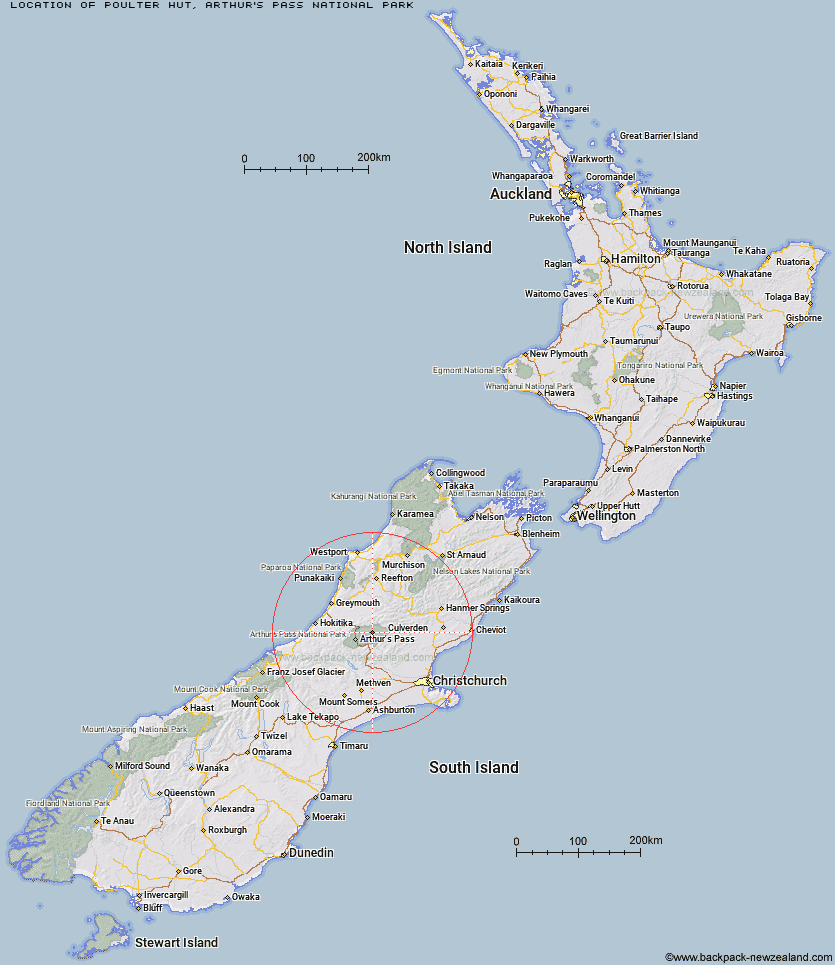
Topo Map showing location of Poulter Hut
This information is sourced from DoC, LINZ and Openstreetmap. Some of the hut photos are mine and the rest are from DoC. I will be adding an upload feature soon so people can photos of .Poulter Hut.
Basic info: standard 10-bunk hut in the North Canterbury and Arthur's Pass area.
Latitude: -42.8494204798
Longitude: 171.809903136
Location: Arthur's Pass National Park
Area: Canterbury
Type of Hut: Standard
Tracks: Minchin Pass Route
Map: BV21 Topo Map | Road Map
Does this hut still exist? Have any more information? Contact
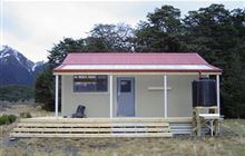
Image: DoC
Scroll down to see a topographical map and road map showing the location of Poulter Hut
[ A ] [ B ] [ C ] [ D ] [ E ] [ F ] [ G ] [ H ] [ I ] [ J ] [ K ] [ L ] [ M ] [ N ] [ O ] [ P ] [ Q ] [ R ] [ S ] [ T ] [ U ] [ V ] [ W ] [ Y ] [ Z ]
Closest 20 Huts to Poulter Hut
These are as the crow fliesWorsley Bivouac 2.2km Trust/Poulter Hut 2.74km Poulter Bivouac 4.96km Minchin Bivouac 6.08km East Hawdon Bivouac 6.26km Ranger Bivouac 7.09km Koropuku Hut 7.42km Otehake Hut 8.14km Townsend Hut 8.76km Hawdon Hut 9.31km Kiwi Hut 11.63km Locke Stream Hut 12.29km Pfeifer Bivouac 12.86km Bull Creek Hut 13.8km Sudden Valley Bivouac 14.06km Turnbull Bivouac 14.32km Harper Pass Bivouac 15.54km Andrews Shelter 16.14km Goat Pass Hut 16.16km Upper Deception Hut 16.19km Hawdon Shelter 16.19km Edwards Hut 16.72km Top Trent / Lagoon Hut 16.75km Mingha Bivouac 16.78km Riversdale Hut 16.95km Upper South Branch Hurunui Hut 17.31km Candlesticks Bivouac 17.57km Elizabeth Hut 18.03km Lochinvar Hut 18.66km Top Crooked Hut 18.82km Mid Trent Hut 19.06km Camerons Hut 19.3km Cone Creek Hut 19.6km Jacko Flat Hut 21.47km North Esk Hut 21.88km Jacks Hut 21.89km Hurunui No 3 Hut 22.01km Carroll Hut 22.02km Lake Morgan Hut 22.26km Greyneys Shelter 23.34km