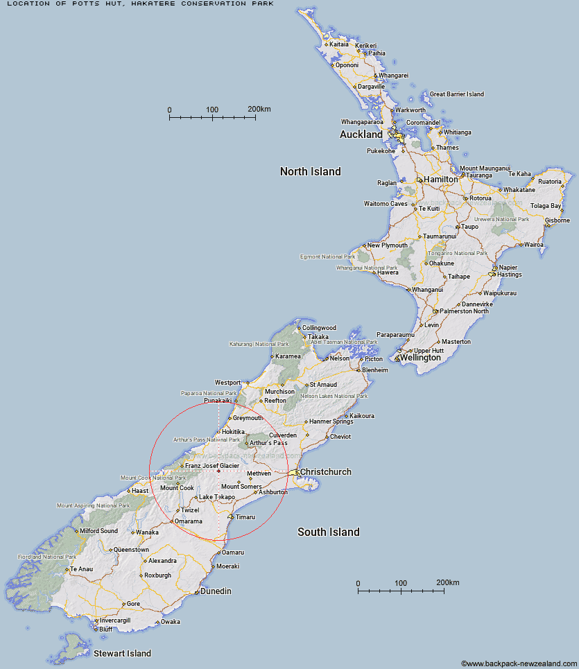
Topo Map showing location of Potts Hut
This information is sourced from DoC, LINZ and Openstreetmap. Some of the hut photos are mine and the rest are from DoC. I will be adding an upload feature soon so people can photos of .Potts Hut.
Basic info: Potts Hut is a basic hut in the Mid and South Canterbury area.
Latitude: -43.4910066385
Longitude: 170.970692429
Location: Hakatere Conservation Park
Area: Canterbury
Type of Hut: Basic/bivvies
Map: BX18 Topo Map | Road Map
Does this hut still exist? Have any more information? Contact
Basic info: Potts Hut is a basic hut in the Mid and South Canterbury area.
Latitude: -43.4910066385
Longitude: 170.970692429
Location: Hakatere Conservation Park
Area: Canterbury
Type of Hut: Basic/bivvies
Map: BX18 Topo Map | Road Map
Does this hut still exist? Have any more information? Contact
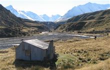
Image: DoC
Scroll down to see a topographical map and road map showing the location of Potts Hut
[ A ] [ B ] [ C ] [ D ] [ E ] [ F ] [ G ] [ H ] [ I ] [ J ] [ K ] [ L ] [ M ] [ N ] [ O ] [ P ] [ Q ] [ R ] [ S ] [ T ] [ U ] [ V ] [ W ] [ Y ] [ Z ]
Closest 20 Huts to Potts Hut
These are as the crow fliesTop Hut 9.11km Boundary Creek Hut 9.18km Lawrence Hut 10.4km Erewhon Station Hut 10.98km Hermitage Hut 11.15km Highland Home 11.79km Black Mountain Hut 13.24km Cameron Hut 14.3km Lawrence Bivouac 16.28km Dog Kennel Bivouac 16.56km Watchdog Hut 17.36km Growler Hut 18.84km McCoy Hut 20.13km Charlies Hut 20.6km Crooked Spur Hut 20.77km Curtis Memorial Hut 21.28km Downs Hut 21.54km Lyell Hut 21.9km Thompsons Hut 22.3km Banfield Hut 22.49km Mistake Flats Hut 22.85km Double Hut 23.41km Manuka Hut 23.41km Reischek Hut 23.49km Murphys Bivvy 23.81km Washbourne Hut 24.24km Saint Winifreds Hut 24.63km Lauper Bivouac 24.74km Carneys Bivvy's 24.87km Jellicoe Hut 26.1km Evans Hut 26.18km Forbes Bivouac 26.19km Stone Hut 27.02km Felt Hut 29.05km Taffy Hut 29.26km Woolshed Creek Hut 31.14km Macaulay Hut 31.23km Three Creeks Hut 32.08km Royal Hut 32.32km Comyns Hut 32.74km