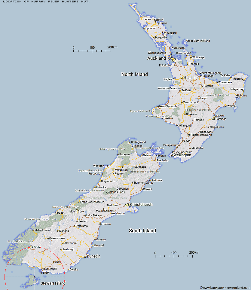
Topo Map showing location of Murray River Hunters Hut
This information is sourced from DoC, LINZ and Openstreetmap. Some of the hut photos are mine and the rest are from DoC. I will be adding an upload feature soon so people can photos of .Murray River Hunters Hut.
Latitude: -46.7816943525
Longitude: 167.998385137
Location:
Type of Hut:
Map: Topo Map | Road Map
Does this hut still exist? Have any more information? Contact
Latitude: -46.7816943525
Longitude: 167.998385137
Location:
Type of Hut:
Map: Topo Map | Road Map
Does this hut still exist? Have any more information? Contact
Scroll down to see a topographical map and road map showing the location of Murray River Hunters Hut
[ A ] [ B ] [ C ] [ D ] [ E ] [ F ] [ G ] [ H ] [ I ] [ J ] [ K ] [ L ] [ M ] [ N ] [ O ] [ P ] [ Q ] [ R ] [ S ] [ T ] [ U ] [ V ] [ W ] [ Y ] [ Z ]
Closest 20 Huts to Murray River Hunters Hut
These are as the crow fliesChristmas Village Hunters Hut 3.69km Bungaree Hut 4.05km Christmas Village Hut 4.45km Port William Hut 9.04km Freshwater Hut 11.32km North Arm Hut 11.4km Yankee River Hut 12.81km Smoky Hunters Hut 15.35km Freds Camp Hut 16.39km South West Arm Hunters Hut 17.14km Long Harry Hut 17.48km Abrahams Bay Hunters Hut 18.59km Hapuatuna Hunters Hut 20.02km Big Hellfire Hut 20.14km East Ruggedy Hut 20.27km Homestead Hunters Hut 21.78km Island Hill Run Deer Pen 21.92km North Big Glory Hunters Hut 21.98km Mason Bay Hut 23.13km Rakeahua Hut 24.01km Little Glory Hunters Hut 24.47km Martins Creek Hunters Hut 25.16km Cavalier Hunters Hut 29.11km Chew Tobacco Hunters Hut 30.98km Port Adventure Hunters Hut 32.71km Lords River Hunters Hut 32.85km Kellys Hunters Hut 35.05km North Tikotatahi Hunters Hut 35.67km Doughboy Bay Hut 35.68km North Pegasus Hunters Hut 52.73km South Pegasus Hunters Hut 53.92km Turnbull's (Big Dam) Hut 55.62km Martin's Hut 58.65km Port Craig School Hut 79.01km Port Craig Lodge 79.05km Percy Burn Hut 80.15km Wairaurahiri Hut 83.76km Okaka Lodge 87km Waitutu Hut 93.75km Teal Bay Hut 96.08km