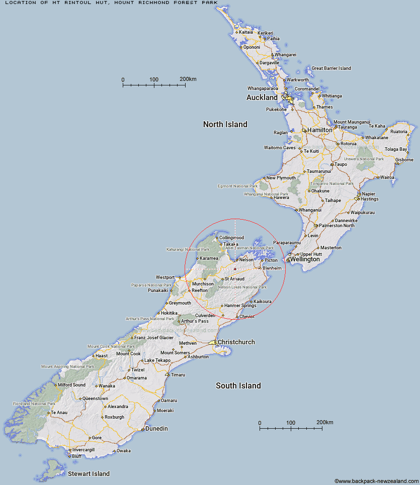
Topo Map showing location of Mt Rintoul Hut
This information is sourced from DoC, LINZ and Openstreetmap. Some of the hut photos are mine and the rest are from DoC. I will be adding an upload feature soon so people can photos of .Mt Rintoul Hut.
Basic info: standard 6-bunk hut in the South Marlborough area.
Latitude: -41.5192865643
Longitude: 173.220639812
Location: Mount Richmond Forest Park
Area: Marlborough
Type of Hut: Standard
Tracks: Alpine Route
Map: BR26 Topo Map | Road Map
Does this hut still exist? Have any more information? Contact
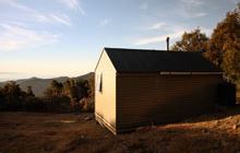
Image: DoC
Scroll down to see a topographical map and road map showing the location of Mt Rintoul Hut
[ A ] [ B ] [ C ] [ D ] [ E ] [ F ] [ G ] [ H ] [ I ] [ J ] [ K ] [ L ] [ M ] [ N ] [ O ] [ P ] [ Q ] [ R ] [ S ] [ T ] [ U ] [ V ] [ W ] [ Y ] [ Z ]
Closest 20 Huts to Mt Rintoul Hut
These are as the crow fliesOld Man Hut 4.24km Tarn Hut 5.68km Slaty Hut 6.1km Mid Goulter Hut 6.92km Starveall Hut 7.05km Lake Chalice Hut 9.89km Mid Wairoa Hut 10.05km Lower Goulter Hut 11.02km Hacket Hut 11.69km Browning Hut 12.63km Richmond Saddle Hut 14.46km Top Wairoa Hut 15.8km Roebuck Hut 16.49km Mt Fell Hut 17.56km Hunters Hut 20.19km Rocks Hut 20.29km Middy Creek Hut 20.76km Third House Shelter 23.25km Dun Shelter 23.27km Fishtail Hut 23.82km Porters Creek Hut 23.84km Captain Creek Hut 24.09km Hidden Hut 25.3km Turkeys Nest Bivouac 26.69km Gosling Hut 29.52km Boulder Forks Hut 30.24km Red Hills Hut 30.29km Devils Creek Hut 31.84km Caves Hut 32.03km Beebys Hut 32.77km Silverstream Bivouac 33.95km Fosters Hut 36.35km Greigs Hut 36.57km Mid Silverstream Hut 36.91km Chimney 37.04km Barbers Hut 38.52km Blue Mountain Hut 39.14km Bull Paddock Creek Hut 39.51km Top Whare 40.02km Mt Sunday Bivouac 40.1km