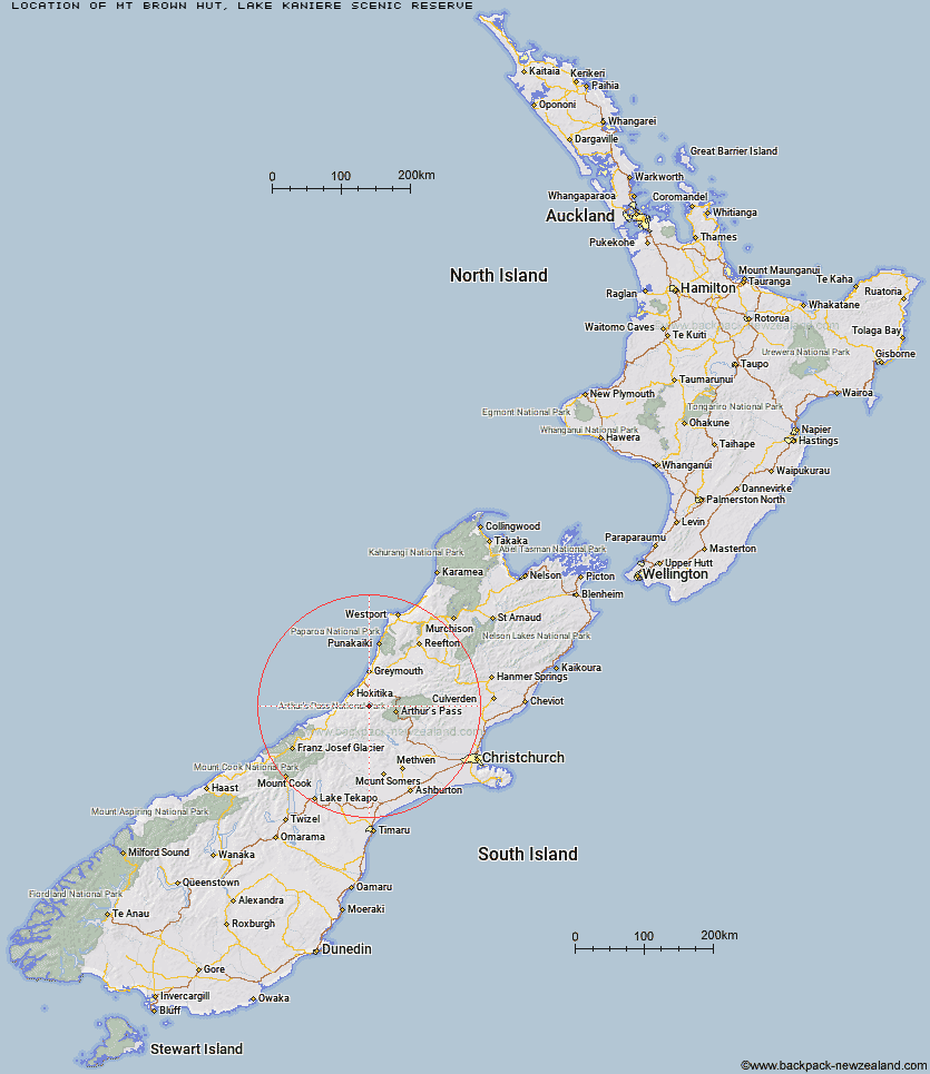
Topo Map showing location of Mt Brown Hut
This information is sourced from DoC, LINZ and Openstreetmap. Some of the hut photos are mine and the rest are from DoC. I will be adding an upload feature soon so people can photos of .Mt Brown Hut.
Basic info: This hut has magnificent views from the hut deck that overlook Lake Kaniere, Hokitika and out to sea.
Latitude: -42.8690544622
Longitude: 171.200098471
Location: Lake Kaniere Scenic Reserve
Area: West Coast
Type of Hut: Basic/bivvies
Map: Topo Map | Road Map
Does this hut still exist? Have any more information? Contact
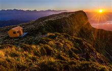
Image: DoC
Scroll down to see a topographical map and road map showing the location of Mt Brown Hut
[ A ] [ B ] [ C ] [ D ] [ E ] [ F ] [ G ] [ H ] [ I ] [ J ] [ K ] [ L ] [ M ] [ N ] [ O ] [ P ] [ Q ] [ R ] [ S ] [ T ] [ U ] [ V ] [ W ] [ Y ] [ Z ]
Closest 20 Huts to Mt Brown Hut
These are as the crow fliesMt Brown Hut 0km Mid Styx Hut 4.7km Newton Range Bivouac 5.96km Boo Boo Hut 6.59km Browning Range Bivouac 7.31km Pinnacle Bivouac 7.85km Grassy Flat Hut 7.92km Lower Arahura Hut 8.32km Lower Olderog Bivouac 9.3km Top Crawford Hut 9.77km Crawford Junction Hut 10.54km Harman Hut 11.38km Cedar Flat Hut 11.39km Adventure Bivouac 11.76km Top Olderog Bivouac 12.56km Top Kokatahi Hut 12.71km Campbell Bivouac 13.11km Yeats Ridge Hut 13.48km Mudflats Hut 13.74km Gerhardt Spur Bivouac 14.32km Crystal Bivouac 14.68km Newton Creek Hut 14.8km Mullins Hut 15.51km Park Morpeth Hut 16.24km Top Toaroha Hut 16.48km Griffin Creek Hut 16.87km Mungo Hut 17.46km Toaroha Saddle Bivouac 17.47km Julia Hut 18.56km Scottys Bivouac 18.61km Old Julia Hut 18.63km Serpentine Hut 18.83km Poet Hut 18.96km Dunns Creek Hut 19.01km Rocky Creek Bivouac 19.37km Frisco Hut 19.49km Mid Taipo Hut 19.94km Bluff Hut 20.64km Urquhart's Hut 20.67km Barker Hut 20.89km