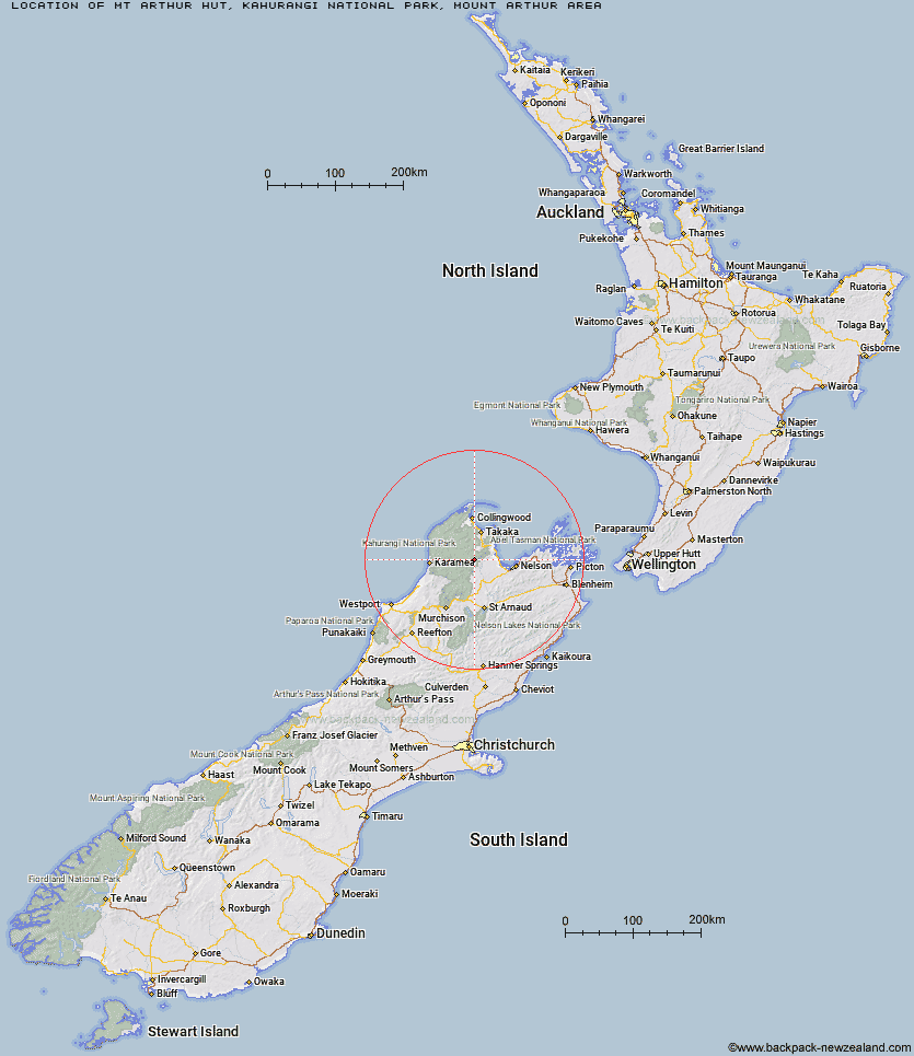
Topo Map showing location of Mt Arthur Hut
This information is sourced from DoC, LINZ and Openstreetmap. Some of the hut photos are mine and the rest are from DoC. I will be adding an upload feature soon so people can photos of .Mt Arthur Hut.
Basic info: This hut is great as a half day walk or as an overnight tramp for families with children or new trampers.
Latitude: -41.1977360611
Longitude: 172.715691374
Location: Kahurangi National Park, Mount Arthur area
Area: Nelson/Tasman
Type of Hut: Serviced
Tracks: Flora Hut and Mount Arthur Hut tracks|Ellis Basin Route
Map: BQ24 Topo Map | Road Map
Does this hut still exist? Have any more information? Contact
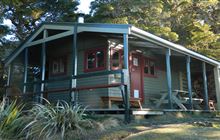
Image: DoC
Scroll down to see a topographical map and road map showing the location of Mt Arthur Hut
[ A ] [ B ] [ C ] [ D ] [ E ] [ F ] [ G ] [ H ] [ I ] [ J ] [ K ] [ L ] [ M ] [ N ] [ O ] [ P ] [ Q ] [ R ] [ S ] [ T ] [ U ] [ V ] [ W ] [ Y ] [ Z ]
Closest 20 Huts to Mt Arthur Hut
These are as the crow fliesFlora Hut 2.06km Upper Gridiron Hut and Rock Shelters 3.41km Growler Rock Shelter 4.84km Ellis Hut 5.11km Dry Rock Shelter 5.15km Asbestos Cottage 7.82km Balloon Hut 8.43km Splugeons Rock Shelter 9km Myttons Hut 10.46km Trilobite Hut 11.65km Sylvester Hut 11.82km Flanagans Hut 13.28km Chaffey Hut 16.68km Riordans Hut 17.08km Waingaro Forks Hut 17.28km Karamea Bend Hut 17.57km Tin Hut Shelter 20.65km Tent Camp 20.97km Cobb Hut 22.44km Fenella Hut 22.93km Crow Hut 23.23km Soper Shelter 23.5km Roaring Lion Hut 23.6km Venus Hut 26.62km John Reid Hut 26.63km Lonely Lake Hut 27.33km Thor Hut 28.93km Kiwi Saddle Hut 29.71km Anatoki Forks Hut 30.12km Adelaide Tarn Hut 31.83km Castle Rock Hut 32.98km Stone Hut 33.87km Moa Park Shelter 34.26km Boulder Lake Hut 35.04km Trevor Carter Hut 35.15km Holyoake Clearing Shelter 35.35km Kings Creek Hut 35.63km Cecil Kings Hut 35.86km Wainui Hut 35.88km Greys Hut 37.09km