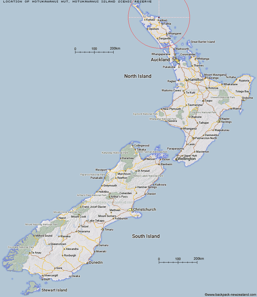
Topo Map showing location of Motukawanui Hut
This information is sourced from DoC, LINZ and Openstreetmap. Some of the hut photos are mine and the rest are from DoC. I will be adding an upload feature soon so people can photos of .Motukawanui Hut.
Basic info: Motukawanui Island is a good base to experience Northland's Cavalli Islands. Stay overnight at this serviced platform-style bunk hut (sleeps 12).
Latitude: -35.0069659455
Longitude: 173.937289824
Location: Motukawanui Island Scenic Reserve
Area: Northland
Type of Hut: Serviced
Map: AV29 Topo Map | Road Map
Does this hut still exist? Have any more information? Contact
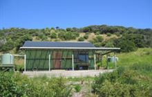
Image: DoC
Scroll down to see a topographical map and road map showing the location of Motukawanui Hut
[ A ] [ B ] [ C ] [ D ] [ E ] [ F ] [ G ] [ H ] [ I ] [ J ] [ K ] [ L ] [ M ] [ N ] [ O ] [ P ] [ Q ] [ R ] [ S ] [ T ] [ U ] [ V ] [ W ] [ Y ] [ Z ]
Closest 20 Huts to Motukawanui Hut
These are as the crow fliesMotukawanui Hut 0km Lane Cove Hut 18.8km Puketi Forest Hut 26.25km Cape Brett Hut 40.28km Frampton's Hut 70.24km Tangihua Hut 95.09km Tangihua Lodge 99.84km Peach Cove Hut 110.36km Kaiaraara Hut 184.6km Mt Heale Hut 187.63km Ongaruanuku Hut 218.5km Piggotts Hut 255.38km Crosbies Hut 271.67km Pinnacles Hut 276.93km Daly's Clearing Hut 320.45km Mangakino Shelter 322.73km Waitawheta Hut 326.41km Wairoa Shelter 329.79km Te Rereatukahia Hut 333.2km Motutapere Hut 337.08km Kauritatahi Hut 342.11km Pahautea Hut 347.74km Ngamuwahine Shelter 355.28km Mangamuka Hut 355.44km Hurunui Hut 359.71km Hamilton Tomo Group Hut 375.82km Leitchs Hut 388.08km Wildlife Hut 398.26km Wairua Hut 422.38km Bog Inn Hut 425.2km Waihaha Hut 435.96km Hauhungaroa Hut 439.22km Rerekapa Hut 442.21km Waihua Hut 448.9km Twain (Waipotiki) Hut 449.64km Saddle (Mangaawai) Hut 451.38km Mangamako Hut 451.4km Casino Hut 453.24km Apiti Hut 453.28km Wharekahika Hut 454.23km