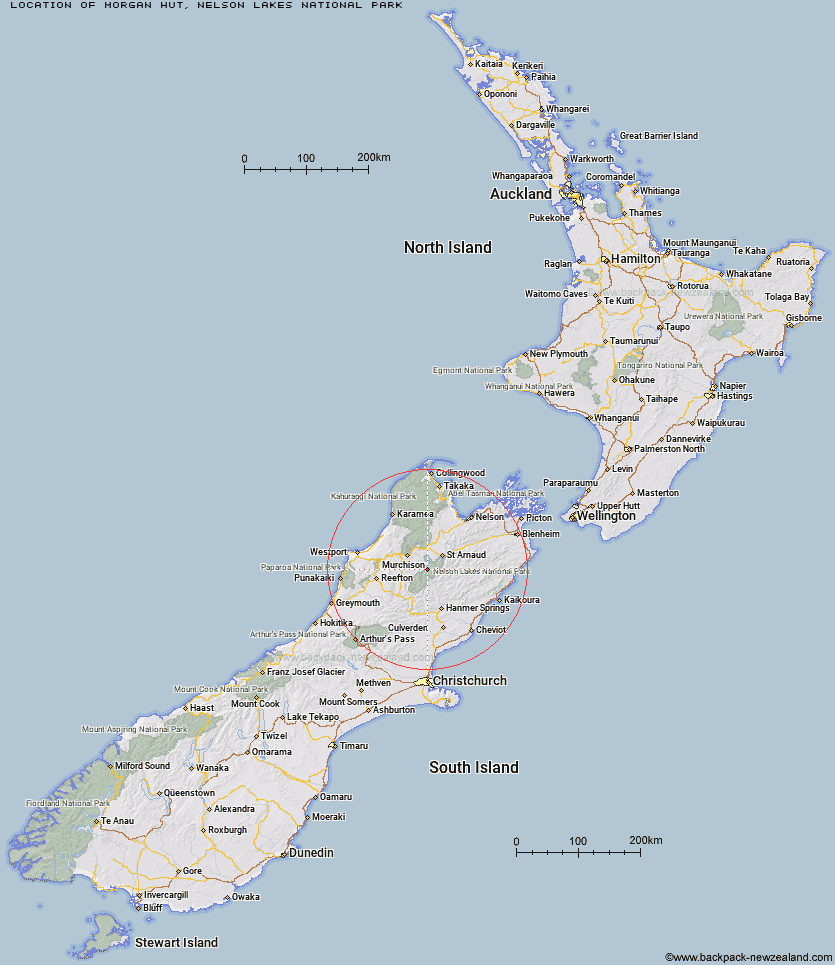
Topo Map showing location of Morgan Hut
This information is sourced from DoC, LINZ and Openstreetmap. Some of the hut photos are mine and the rest are from DoC. I will be adding an upload feature soon so people can photos of .Morgan Hut.
Basic info: standard ten-bunk hut in the Nelson Lakes area.
Latitude: -41.9827251352
Longitude: 172.630828441
Location: Nelson Lakes National Park
Area: Nelson/Tasman
Type of Hut: Standard
Map: BS24 Topo Map | Road Map
Does this hut still exist? Have any more information? Contact
Basic info: standard ten-bunk hut in the Nelson Lakes area.
Latitude: -41.9827251352
Longitude: 172.630828441
Location: Nelson Lakes National Park
Area: Nelson/Tasman
Type of Hut: Standard
Map: BS24 Topo Map | Road Map
Does this hut still exist? Have any more information? Contact
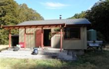
Image: DoC
Scroll down to see a topographical map and road map showing the location of Morgan Hut
[ A ] [ B ] [ C ] [ D ] [ E ] [ F ] [ G ] [ H ] [ I ] [ J ] [ K ] [ L ] [ M ] [ N ] [ O ] [ P ] [ Q ] [ R ] [ S ] [ T ] [ U ] [ V ] [ W ] [ Y ] [ Z ]
Closest 20 Huts to Morgan Hut
These are as the crow fliesWest Sabine Hut 5.22km Mole Hut 5.41km Mount Misery Hut 6.32km George Lyon Hut 7.51km Cupola Hut 8.52km Blue Lake Hut 8.64km D'Urville Hut 8.67km Tiraumea Hut 9.26km Matakitaki Base Hut 9.9km Sabine Hut 9.99km Upper Travers Hut 10.69km John Tait Hut 11.43km Hopeless Hut 11.92km Upper D'Urville Hut 14.12km Angelus Hut 14.32km Begley Hut 15.03km Paske Hut 17.59km Speargrass Hut 17.67km Downie Hut 18.89km Caroline Creek Bivouac 19.15km Lakehead Hut 19.8km Coldwater Hut 19.83km Nardoo Hut 20.87km Connors Creek Hut 21.17km Relax Shelter 22.08km Bushedge Shelter 22.46km Bushline Hut 22.74km East Matakitaki Hut 24.2km Island Gully Hut 24.3km Burn Creek Hut 24.47km Sedgemere Sleepout 27.96km Lees Creek Hut 28.77km Bobs Hut 29.34km Top Misery Hut 32km Branch Bivouac 33.65km Lake Guyon Hut 33.87km Christopher Cullers Hut 33.95km Christopher Hut 34.43km Bull Paddock Creek Hut 34.54km Severn Hut 34.67km