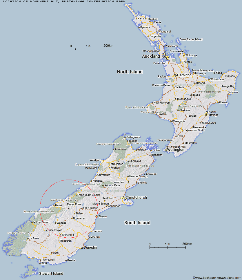
Topo Map showing location of Monument Hut
This information is sourced from DoC, LINZ and Openstreetmap. Some of the hut photos are mine and the rest are from DoC. I will be adding an upload feature soon so people can photos of .Monument Hut.
Basic info: standard six-bunk hut in the Mackenzie Country and Waitaki area.
Latitude: -44.0239920298
Longitude: 169.811924902
Location: Ruataniwha Conservation Park
Area: Canterbury
Type of Hut: Standard
Tracks: Hopkins valley tracks
Map: BY14 Topo Map | Road Map
Does this hut still exist? Have any more information? Contact
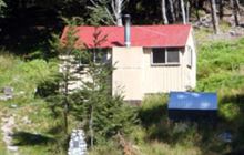
Image: DoC
Scroll down to see a topographical map and road map showing the location of Monument Hut
[ A ] [ B ] [ C ] [ D ] [ E ] [ F ] [ G ] [ H ] [ I ] [ J ] [ K ] [ L ] [ M ] [ N ] [ O ] [ P ] [ Q ] [ R ] [ S ] [ T ] [ U ] [ V ] [ W ] [ Y ] [ Z ]
Closest 20 Huts to Monument Hut
These are as the crow fliesRed Hut 3.31km Main Huxley Forks Hut 5.76km South Huxley Bivouac 6.16km Dasler Bivouac 8km Brodrick Hut 8.59km Le Crens Hut 8.93km Elcho Hut 10.41km Cullers Hut 11.5km South Temple Hut 13.07km Station Hut 13.29km Stony Stream Bivouac 14.23km Grough Hut 14.76km Creswicke Flat Hut 14.93km Dodger Hut 15.21km Forbes Hut 15.62km Top Hut 16.02km Hagens Hut 20.08km Kennedy Hut 20.09km Erceg Hut 21.36km Maitland Hut 22.11km Baikie Hut 22.26km Ferguson Hut 23.43km Richardson Rock Bivouac 23.58km Whale Stream Hut 23.71km Shamrock Hut 25.34km Waterfall Hut 25.5km Bull Flat Hut 26.47km Wills Hut 28.04km Reardon Hut 28.79km Scrubby Hut 29.47km Snowy Gorge Hut 30.2km Tunnel Creek Hut 31.74km Makarora Hut 31.9km Ahuriri Base Hut 32.38km Brewster Hut 32.72km Barron Saddle Hut 33.11km Christmas Flat Hut 34.87km Top Dingle Hut 35.07km Lame Duck Hut 35.54km Middle Head Hut 36.23km