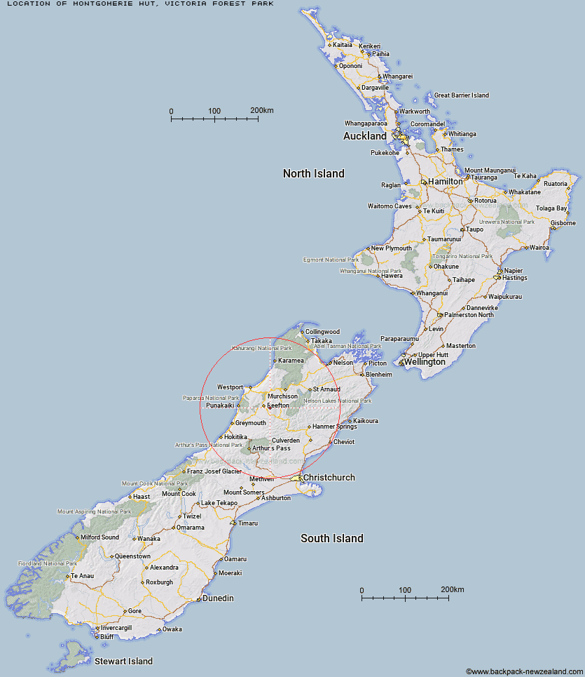
Topo Map showing location of Montgomerie Hut
This information is sourced from DoC, LINZ and Openstreetmap. Some of the hut photos are mine and the rest are from DoC. I will be adding an upload feature soon so people can photos of .Montgomerie Hut.
Basic info: standard six-bunk hut in the Greymouth area.
Latitude: -42.1495503417
Longitude: 171.997440525
Location: Victoria Forest Park
Area: West Coast
Type of Hut: Standard
Tracks: Kirwans Track and Waitahu Valley
Map: BT22 Topo Map | Road Map
Does this hut still exist? Have any more information? Contact
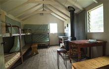
Image: DoC
Scroll down to see a topographical map and road map showing the location of Montgomerie Hut
[ A ] [ B ] [ C ] [ D ] [ E ] [ F ] [ G ] [ H ] [ I ] [ J ] [ K ] [ L ] [ M ] [ N ] [ O ] [ P ] [ Q ] [ R ] [ S ] [ T ] [ U ] [ V ] [ W ] [ Y ] [ Z ]
Closest 20 Huts to Montgomerie Hut
These are as the crow fliesKirwans Hut 5.26km Top Waitahu Bivouac 10.97km Big River Hut 13.63km Wheel Creek Hut 14.12km Lake Stream Hut 15.56km Manson-Nicholls Memorial Hut 29.62km Pell Stream Hut 34.15km Nardoo Hut 36.17km Burn Creek Hut 37.25km Lake Christabel Hut 38.37km Jim's Flat Hut 38.55km Top Robinson Hut 39.48km Mid Robinson Hut 39.56km Brass Monkey Bivouac 39.84km Cannibal Gorge Hut 40.69km Bobs Hut 41.1km Ada Pass Hut 41.6km Upper Nina Bivouac 42.15km Lucretia Hut 42.27km Buckland Peaks Hut 43.15km Downie Hut 43.51km Nina Hut 44.16km Slaty Creek Hut 44.56km Devils Den Bivouac 44.84km Doubtless Hut 45.48km Matakitaki Base Hut 45.59km East Matakitaki Hut 46.44km Lyell Saddle Hut 48.08km Lake Man Bivouac 48.2km Anne Cullers Hut 48.46km Christopher Cullers Hut 48.48km Doubtful Hut 48.5km Anne Hut 49.15km Christopher Hut 49.23km Meikles Hut 49.27km Rokeby Hut 49.68km Upper D'Urville Hut 50.36km Garden Gully Hut 51.08km Top Hope Hut 51.09km George Lyon Hut 51.41km