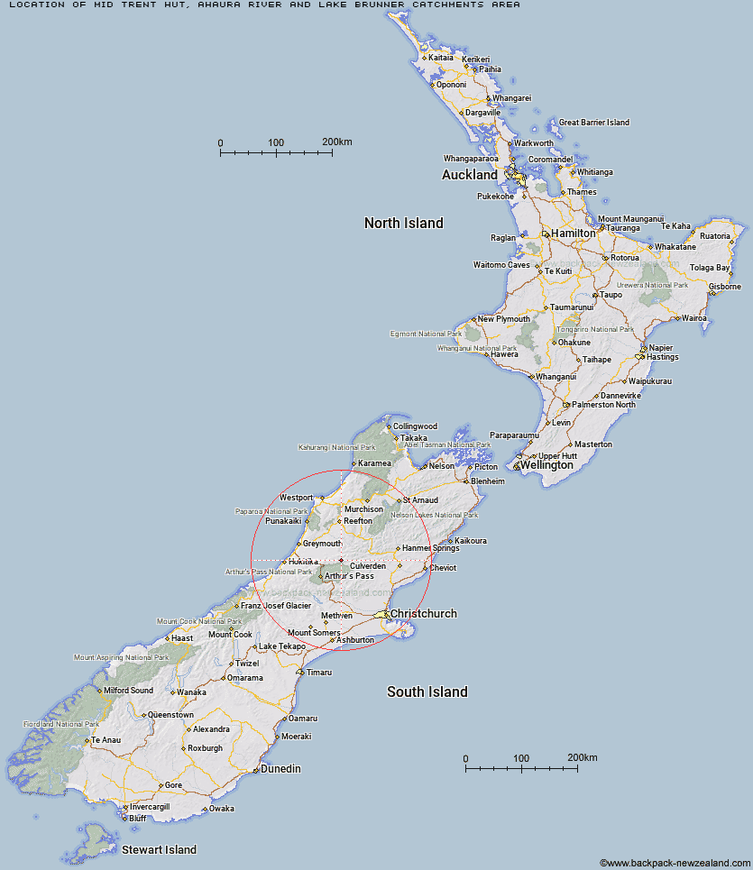
Topo Map showing location of Mid Trent Hut
This information is sourced from DoC, LINZ and Openstreetmap. Some of the hut photos are mine and the rest are from DoC. I will be adding an upload feature soon so people can photos of .Mid Trent Hut.
Basic info: basic four-bunk hut in the Greymouth area.
Latitude: -42.6895941171
Longitude: 171.894371295
Location: Ahaura River and Lake Brunner catchments area
Area: West Coast
Type of Hut: Basic/bivvies
Tracks: Ahaura River & Lake Brunner catchments routes
Map: BU21 Topo Map | Road Map
Does this hut still exist? Have any more information? Contact
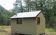
Image: DoC
Scroll down to see a topographical map and road map showing the location of Mid Trent Hut
[ A ] [ B ] [ C ] [ D ] [ E ] [ F ] [ G ] [ H ] [ I ] [ J ] [ K ] [ L ] [ M ] [ N ] [ O ] [ P ] [ Q ] [ R ] [ S ] [ T ] [ U ] [ V ] [ W ] [ Y ] [ Z ]
Closest 20 Huts to Mid Trent Hut
These are as the crow fliesHarper Pass Bivouac 3.94km Top Trent / Lagoon Hut 5.15km Camerons Hut 5.28km Locke Stream Hut 7.66km Hurunui No 3 Hut 7.75km Waikiti Hut 8.98km Elizabeth Hut 9.06km Tutaekuri Hut 10.5km Mackenzie Hut 11.14km Upper South Branch Hurunui Hut 11.21km Cone Creek Hut 13.2km Townsend Hut 13.41km Minchin Bivouac 13.56km Kiwi Hut 14.43km Mackenzie Bivouac 14.73km Lake Morgan Hut 15.41km South Branch Research Hut 16.39km Hurunui Hut 16.56km Top Crooked Hut 16.7km Poulter Bivouac 17.23km Ranger Bivouac 18.46km Candlesticks Bivouac 18.75km Trust/Poulter Hut 18.84km Koropuku Hut 18.85km North Esk Hut 18.89km Stony Stream Hut 19km Poulter Hut 19.06km Worsley Bivouac 20.16km Lake Sumner Hut 20.75km Jacko Flat Hut 21.64km Three Mile Stream Hut 21.66km Slaty Creek Hut 22.38km Pfeifer Bivouac 22.57km Lake Mason Hut 22.83km Bull Creek Hut 23.42km Otehake Hut 23.95km East Hawdon Bivouac 25.3km Bush Camp Hut 25.35km Top Hope Hut 25.54km Ant Stream Bivouac 25.73km