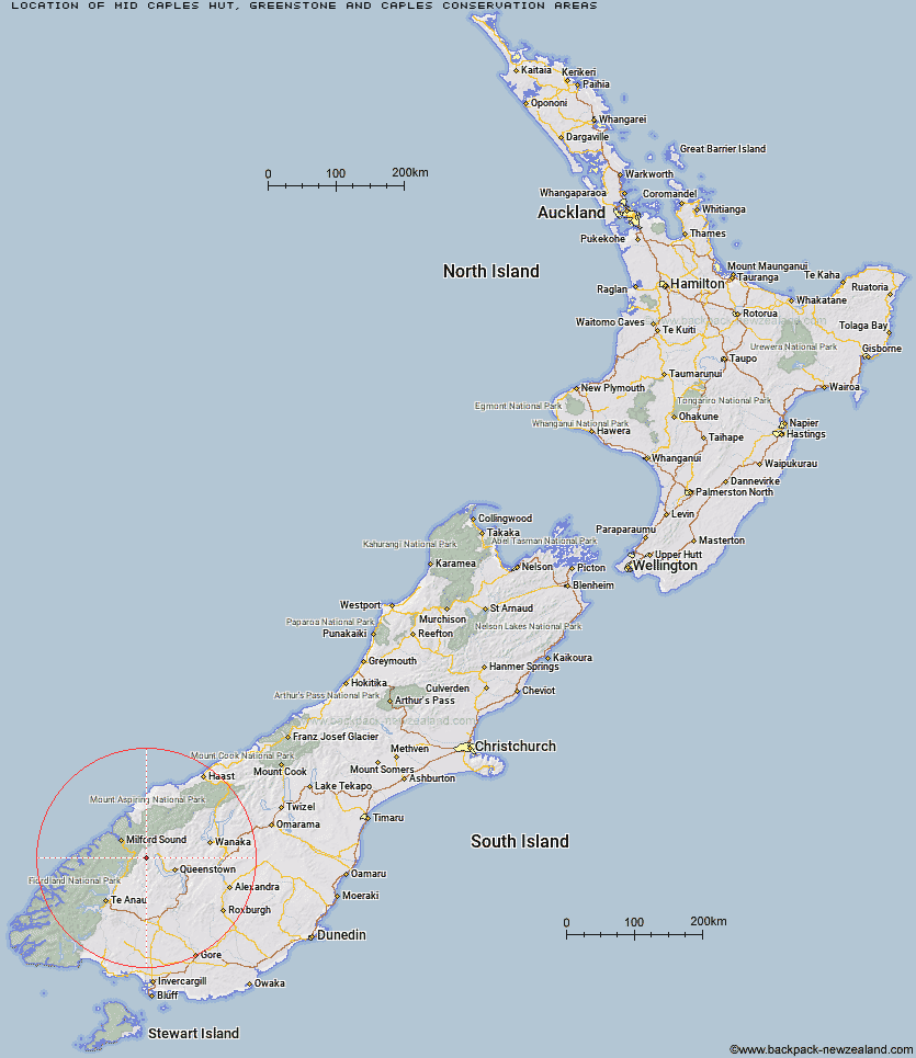
Topo Map showing location of Mid Caples Hut
This information is sourced from DoC, LINZ and Openstreetmap. Some of the hut photos are mine and the rest are from DoC. I will be adding an upload feature soon so people can photos of .Mid Caples Hut.
Basic info: serviced 24-bunk hut in the Queenstown/Wakatipu area.
Latitude: -44.8919200733
Longitude: 168.27313235
Location: Greenstone and Caples Conservation Areas
Area: Otago
Type of Hut: Serviced
Tracks: Greenstone and Caples tracks
Map: CB09 Topo Map | Road Map
Does this hut still exist? Have any more information? Contact
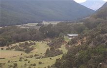
Image: DoC
Scroll down to see a topographical map and road map showing the location of Mid Caples Hut
[ A ] [ B ] [ C ] [ D ] [ E ] [ F ] [ G ] [ H ] [ I ] [ J ] [ K ] [ L ] [ M ] [ N ] [ O ] [ P ] [ Q ] [ R ] [ S ] [ T ] [ U ] [ V ] [ W ] [ Y ] [ Z ]
Closest 20 Huts to Mid Caples Hut
These are as the crow fliesHome Hill Hut 2.74km Steele Creek Hut 6.1km Upper Caples Hut 6.68km Slip Flat Hut 7.17km Rats Nest Hut 9.06km Steele Creek Lodge 9.08km Greenstone Hut 9.75km McKellar Hut 10.34km McKellar Lodge 10.45km Kay Creek Hut 10.53km Lake Howden Hut 13.78km Jean Hut 14.27km Bonnie Jean Hut 14.35km The Divide Shelter 14.35km McIntyre's Hut 14.79km Heather Jock Hut 14.98km Lake Mackenzie Lodge 15.79km Lake Mackenzie Hut 15.9km McIntosh Hut 15.92km Kelly's Hut 16.84km Wallers Hut 17.17km Taipo Hut 18.07km Routeburn Flats Hut 19.04km Routeburn Shelter 19.24km Routeburn Falls Lodge 19.33km Routeburn Falls Hut 19.36km Phil's Bivvy 24.89km Stoney Creek Hut 25.24km Homer Hut 25.44km Gill's Bivvy 25.66km Sam Summers Hut 26.7km Forks Hut 27.21km Glade House 27.32km Butchers Hut 27.56km Boundary Hut 28.52km Clinton Hut 28.78km Archie's Hut - Copper Creek 30.62km Sunshine Hut 31.67km Crystal Hut 31.82km Twenty Five Mile Hut 31.99km