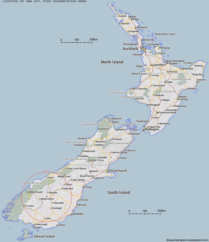
Topo Map showing location of Meg Hut
This information is sourced from DoC, LINZ and Openstreetmap. Some of the hut photos are mine and the rest are from DoC. I will be adding an upload feature soon so people can photos of .Meg Hut.
Basic info: standard eight-bunk hut in the Wanaka/Makarora area.
Latitude: -44.916061829
Longitude: 169.056359985
Location: Pisa Conservation Area
Area: Otago
Type of Hut: Standard
Map: CB12 Topo Map | Road Map
Does this hut still exist? Have any more information? Contact
Basic info: standard eight-bunk hut in the Wanaka/Makarora area.
Latitude: -44.916061829
Longitude: 169.056359985
Location: Pisa Conservation Area
Area: Otago
Type of Hut: Standard
Map: CB12 Topo Map | Road Map
Does this hut still exist? Have any more information? Contact
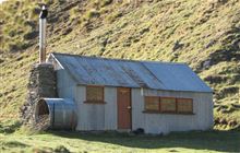
Image: DoC
Scroll down to see a topographical map and road map showing the location of Meg Hut
[ A ] [ B ] [ C ] [ D ] [ E ] [ F ] [ G ] [ H ] [ I ] [ J ] [ K ] [ L ] [ M ] [ N ] [ O ] [ P ] [ Q ] [ R ] [ S ] [ T ] [ U ] [ V ] [ W ] [ Y ] [ Z ]
Closest 20 Huts to Meg Hut
These are as the crow fliesDeep Creek Hut 6.82km Kirtle Burn Hut 9.62km Robrosa Hut 12.33km Eight Mile Hut 17.28km Highland Creek Hut 18.18km Roses Hut 19.67km Fern Burn Hut 20.4km Glen Roy Raceman's Hut 23.66km Cairnmuir Musterer's Hut 26.01km Peats Hut 28.14km Green Gate Huts 28.8km Sainsburys Huts 30.85km Crystal Hut 32.08km Old Woman Hut 32.49km Cabin Hut 32.84km Bullendale Hut 33.39km Dynamo Hut 33.57km Saddle Hut 34.04km Butchers Hut 34.41km Two Mile Hut 34.98km Archie's Hut - Copper Creek 35.63km Polnoon Hut 36.25km Shiel Burn Hut 36.38km Ballarat Hut - Flood Burn 36.45km Stoney Creek Hut 37.69km Whites Hut 39.19km Black Peak Hut 39.72km Sixteen Mile Huts 41.94km Wanaka Faces Hut 43.09km Sam Summers Hut 43.8km Long Burn Hut 44.02km Pakituhi Hut 44.06km Baileys Hut 44.76km Kelly's Hut 45.32km Wallers Hut 45.65km Hundred Mile Hut 46.42km Boundary Hut 46.54km Heather Jock Hut 47.82km McIntosh Hut 48.2km Lauder Basin Hut 48.2km