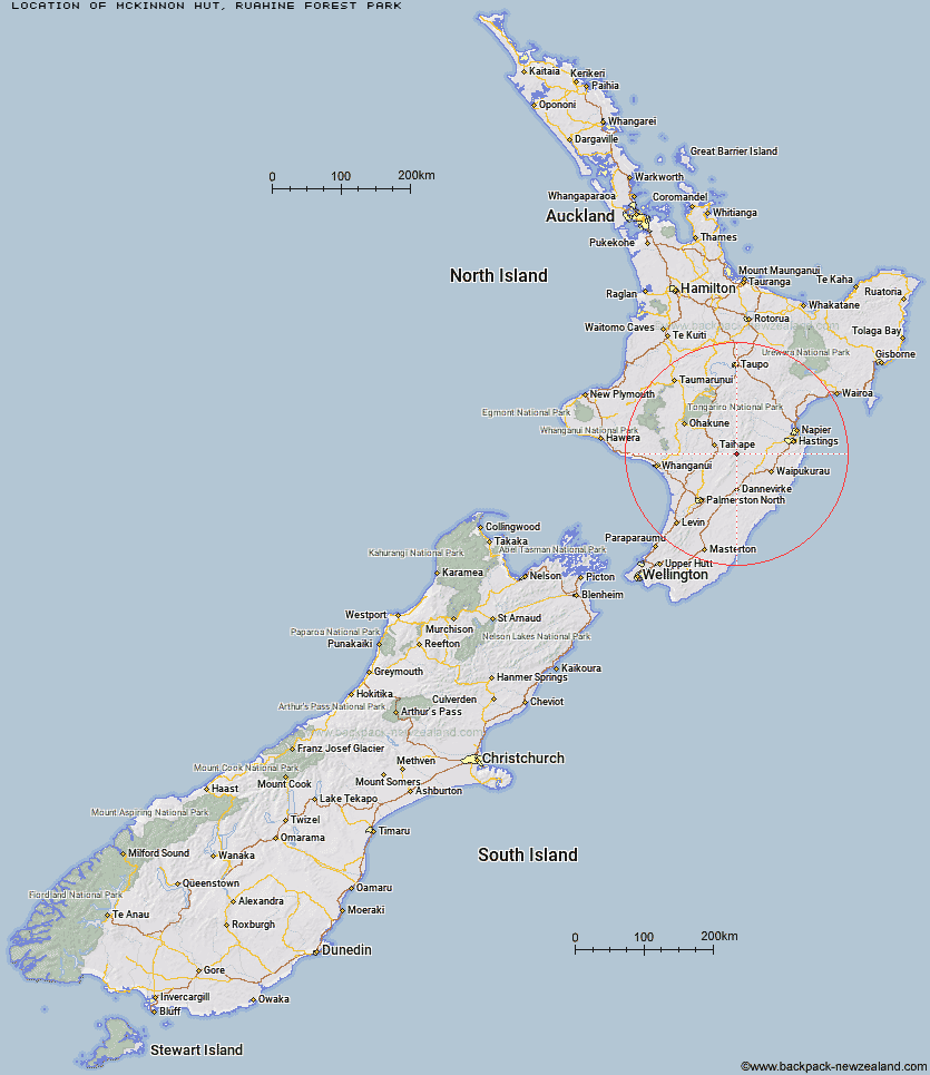
Topo Map showing location of McKinnon Hut
This information is sourced from DoC, LINZ and Openstreetmap. Some of the hut photos are mine and the rest are from DoC. I will be adding an upload feature soon so people can photos of .McKinnon Hut.
Basic info: standard six-bunk hut in the Manawatu.
Latitude: -39.7816388854
Longitude: 176.094747841
Location: Ruahine Forest Park
Area: Manawatu/Whanganui
Type of Hut: Standard
Tracks: McKinnon Hut Track|Purity to Kawhatau Base Track
Map: BK36 Topo Map | Road Map
Does this hut still exist? Have any more information? Contact
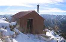
Image: DoC
Scroll down to see a topographical map and road map showing the location of McKinnon Hut
[ A ] [ B ] [ C ] [ D ] [ E ] [ F ] [ G ] [ H ] [ I ] [ J ] [ K ] [ L ] [ M ] [ N ] [ O ] [ P ] [ Q ] [ R ] [ S ] [ T ] [ U ] [ V ] [ W ] [ Y ] [ Z ]
Closest 20 Huts to McKinnon Hut
These are as the crow fliesMcKinnon Hut 0km Crow Hut 1.83km Wakelings Hut 4.24km Waikamaka Hut 4.71km Kawhatau Base 5.04km Purity Hut 5.41km Top Maropea Hut 5.47km Waterfall Hut 5.52km Sunrise Hut 6.3km Maropea Forks Hut 6.87km Waipawa Forks Hut 7.13km Kelly Knight Hut 8.41km Pourangaki Hut 8.64km Sparrowhawk Bivouac 8.7km Otukota Hut 8.7km Triplex Hut 8.93km Gold Creek Hut 9.03km Smiths Stream Hut 9.91km Hinerua Hut 10.97km Iron Bark Hut 11.11km Tarn Bivouac 12.09km Norris Hut 12.38km Barlow Hut 12.51km Colenso Hut 12.86km Triangle Hut 13.75km Rangiwahia Hut 13.78km Howletts Hut 13.91km Kylie Bivouac 14.45km Daphne Hut 15.23km Upper Makaroro Hut 16.06km Iron Gate Hut 16.47km Parks Peak Hut 17.65km Ellis Hut 17.66km Ruahine Corner Hut 17.98km Longview Hut 19.02km Poutaki Hut 19.73km Sentry Box Hut 20.29km Alice Nash Memorial Heritage Lodge 20.35km Top Gorge Hut 20.67km Aranga Hut 21.28km