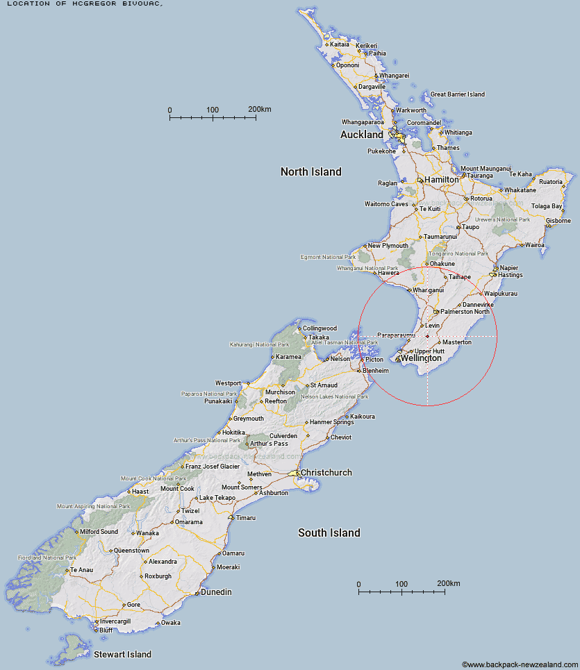
Topo Map showing location of McGregor Bivouac
This information is sourced from DoC, LINZ and Openstreetmap. Some of the hut photos are mine and the rest are from DoC. I will be adding an upload feature soon so people can photos of .McGregor Bivouac.
Latitude: -40.8327089306
Longitude: 175.410906171
Location:
Type of Hut:
Map: Topo Map | Road Map
Does this hut still exist? Have any more information? Contact
Latitude: -40.8327089306
Longitude: 175.410906171
Location:
Type of Hut:
Map: Topo Map | Road Map
Does this hut still exist? Have any more information? Contact
Scroll down to see a topographical map and road map showing the location of McGregor Bivouac
[ A ] [ B ] [ C ] [ D ] [ E ] [ F ] [ G ] [ H ] [ I ] [ J ] [ K ] [ L ] [ M ] [ N ] [ O ] [ P ] [ Q ] [ R ] [ S ] [ T ] [ U ] [ V ] [ W ] [ Y ] [ Z ]
Closest 20 Huts to McGregor Bivouac
These are as the crow fliesDorset Ridge Hut 2.96km Mid King Bivouac 3.21km Jumbo Hut 3.42km Nichols Hut 3.86km Anderson Memorial Hut 4.86km Carkeek Hut 4.88km Tarn Ridge Hut 5.12km Mid Waiohine Hut 5.21km Atiwhakatu Hut 5.36km Mitre Flats Hut 5.71km Powell Hut 5.9km Mountain House Shelter 7.1km Dracophyllum Hut 7.24km Aokaparangi Hut 7.83km Arete Forks Hut 8.4km Waitewaewae Hut 8.81km Cow Creek Hut 9.17km Arete Hut 9.61km Blue Range Hut 10.07km Te Matawai Hut 10.63km Maungahuka Hut 10.96km Totara Flats Hut 11.14km Neill Forks Hut 12.04km Waiopehu Hut 12.67km Sayer Hut 12.73km South Ohau Hut 12.88km Penn Creek Hut 12.97km Dundas Hut 13.73km Cattle Ridge Hut 13.83km Roaring Stag Hut 14.84km North Ohau Hut 15.11km Field Hut 15.46km Mangahao Flats Hut 15.81km Kime Hut 16.94km Cone Hut 18.06km Herepai Hut 18.27km Waikawa Shelter 18.58km Waiohine Shelter 19.52km Alpha Hut 20.18km Tutuwai Hut 21.01km