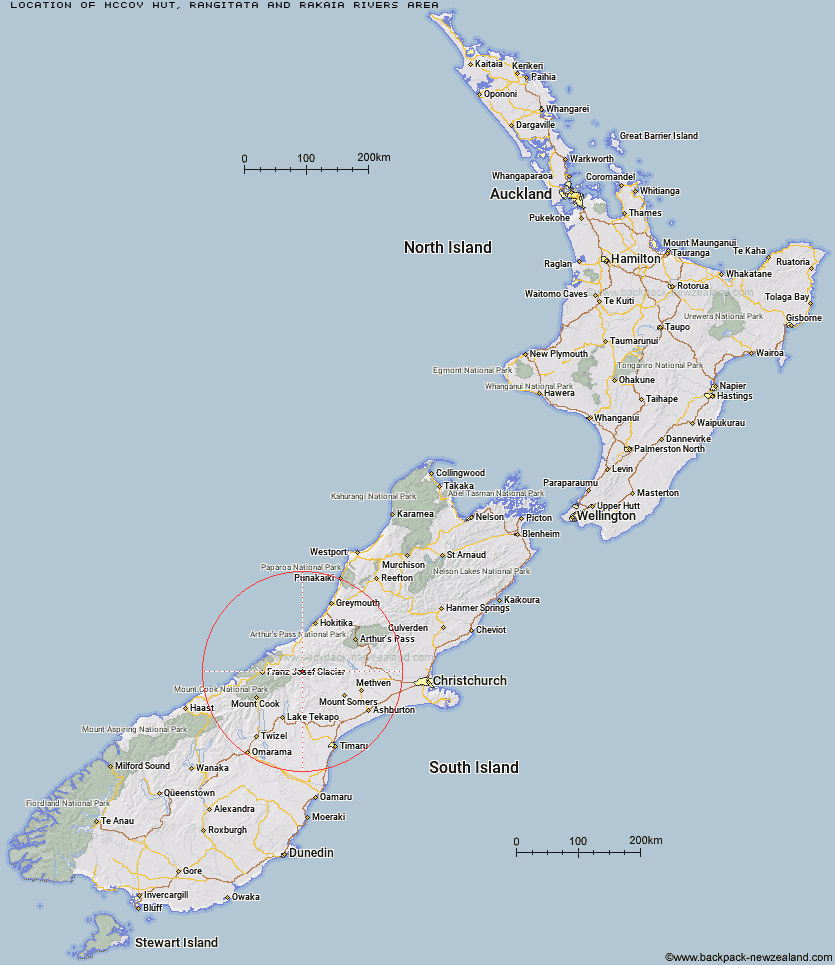
Topo Map showing location of McCoy Hut
This information is sourced from DoC, LINZ and Openstreetmap. Some of the hut photos are mine and the rest are from DoC. I will be adding an upload feature soon so people can photos of .McCoy Hut.
Basic info: standard six-bunk hut in the Mid and South Canterbury area.
Latitude: -43.3783226092
Longitude: 170.77559038
Location: Rangitata and Rakaia Rivers area
Area: Canterbury
Type of Hut: Standard
Map: BW17 Topo Map | Road Map
Does this hut still exist? Have any more information? Contact
Basic info: standard six-bunk hut in the Mid and South Canterbury area.
Latitude: -43.3783226092
Longitude: 170.77559038
Location: Rangitata and Rakaia Rivers area
Area: Canterbury
Type of Hut: Standard
Map: BW17 Topo Map | Road Map
Does this hut still exist? Have any more information? Contact
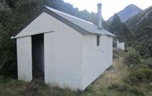
Image: DoC
Scroll down to see a topographical map and road map showing the location of McCoy Hut
[ A ] [ B ] [ C ] [ D ] [ E ] [ F ] [ G ] [ H ] [ I ] [ J ] [ K ] [ L ] [ M ] [ N ] [ O ] [ P ] [ Q ] [ R ] [ S ] [ T ] [ U ] [ V ] [ W ] [ Y ] [ Z ]
Closest 20 Huts to McCoy Hut
These are as the crow fliesWatchdog Hut 3.48km Saint Winifreds Hut 8.62km Erewhon Station Hut 9.68km Curtis Memorial Hut 9.69km Lawrence Hut 10.04km Mistake Flats Hut 10.21km Hermitage Hut 11.02km Lawrence Bivouac 12.08km Murphys Bivvy 12.72km Lyell Hut 13.97km Forbes Bivouac 14.1km Growler Hut 15.04km Carneys Bivvy's 15.98km Scone Hut 16.68km Hunters Hut 16.97km Black Mountain Hut 18.36km Reischek Hut 18.77km Lauper Bivouac 19.6km Cameron Hut 19.64km Smyth Hut 19.74km Potts Hut 20.13km Top Hut 21km Washbourne Hut 22.82km Dog Kennel Bivouac 23.03km Nolans Hut 23.96km Godley Hut 24.23km Banfield Hut 24.35km Highland Home 24.36km Evans Hut 24.51km Scamper Torrent Hut 25.16km County Stream Hut 25.21km Thompsons Hut 26.35km Macaulay Hut 26.42km Moonbeam Hut 26.59km Kiwi Flat Hut 27.11km Crooked Spur Hut 27.33km Top Butler Hut 27.48km Neave Hut 27.64km Eade Memorial Hut 28.43km Red Stag Hut 28.46km