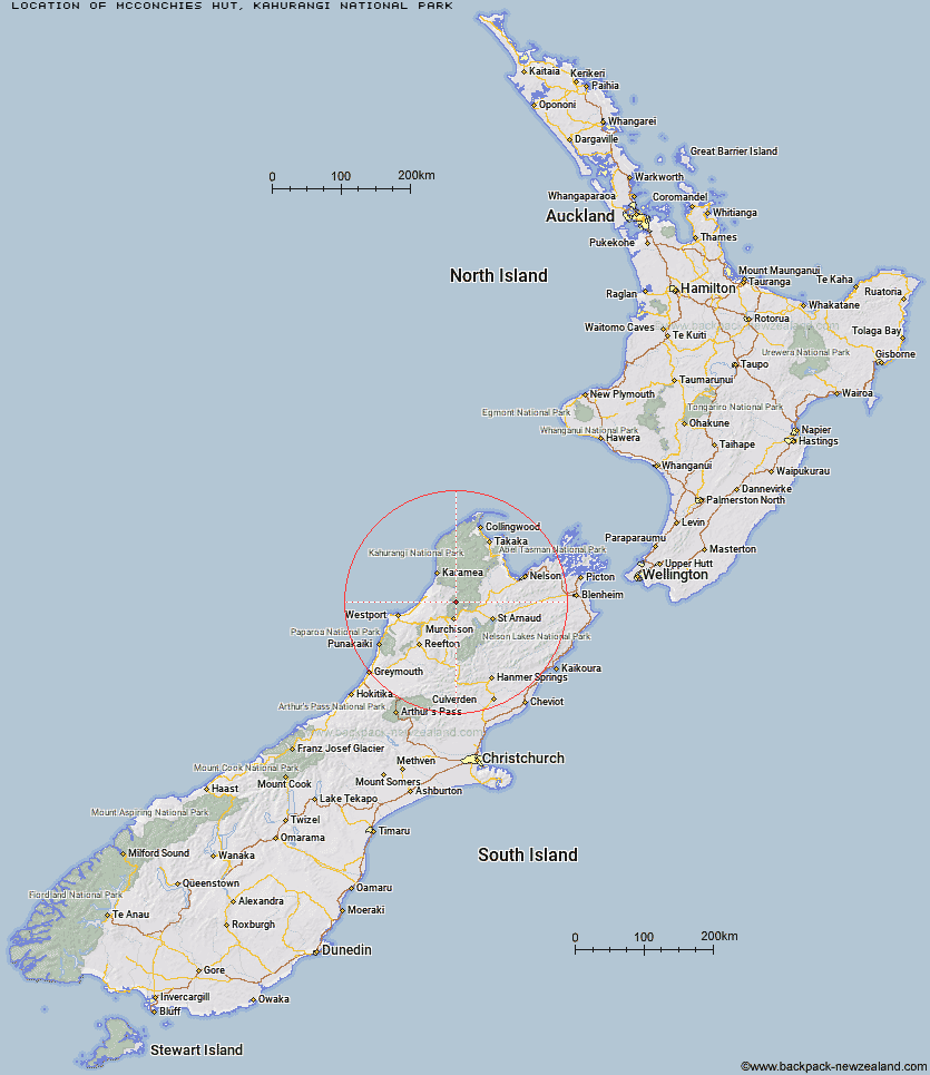
Topo Map showing location of McConchies Hut
This information is sourced from DoC, LINZ and Openstreetmap. Some of the hut photos are mine and the rest are from DoC. I will be adding an upload feature soon so people can photos of .McConchies Hut.
Basic info: standard 4-bunk hut in the Nelson Lakes area.
Latitude: -41.5874901883
Longitude: 172.364305696
Location: Kahurangi National Park
Area: Nelson/Tasman
Type of Hut: Standard
Tracks: Matiri Valley and 1000 Acre Plateau tramping tracks
Map: BR23 Topo Map | Road Map
Does this hut still exist? Have any more information? Contact
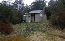
Image: DoC
Scroll down to see a topographical map and road map showing the location of McConchies Hut
[ A ] [ B ] [ C ] [ D ] [ E ] [ F ] [ G ] [ H ] [ I ] [ J ] [ K ] [ L ] [ M ] [ N ] [ O ] [ P ] [ Q ] [ R ] [ S ] [ T ] [ U ] [ V ] [ W ] [ Y ] [ Z ]
Closest 20 Huts to McConchies Hut
These are as the crow fliesMcConchies Hut 0km Poor Pete's Hut 4.58km Larrikin Creek Hut 5.05km Lake Matiri Hut 8.13km Hurricane Hut 9.1km Goat Creek Hut 13.92km Branch Creek Hut 14.1km Johnson Hut 15.24km Mokihinui Forks Hut 16.06km Stern Valley Hut 16.15km Cecil Kings Hut 16.47km Kings Creek Hut 16.7km Granity Pass Hut 17.88km Specimen Point Hut 18.27km Helicopter Flat Hut 19.07km Stone Hut 19.58km Ghost Lake Hut 21.16km Trevor Carter Hut 21.17km Taipo Hut 21.49km Stag Flat Shelter 22km Kiwi Saddle Hut 22.81km Wangapeka Bivouac 24.22km John Reid Hut 25.74km Lyell Saddle Hut 26.74km Thor Hut 26.79km Belltown Manunui Hut 28.48km Kākāpō Hut 28.8km Venus Hut 30.74km Crow Hut 33.83km Greys Hut 39.44km Flanagans Hut 39.88km Tiraumea Hut 39.93km Karamea Bend Hut 41.26km D'Urville Hut 42.41km Speargrass Hut 43.62km Sabine Hut 43.68km Roaring Lion Hut 43.7km Mole Hut 45km Adams Flat Hut 45.17km Bushedge Shelter 45.93km