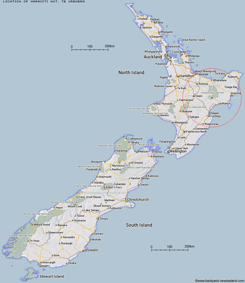
Topo Map showing location of Marauiti Hut
This information is sourced from DoC, LINZ and Openstreetmap. Some of the hut photos are mine and the rest are from DoC. I will be adding an upload feature soon so people can photos of .Marauiti Hut.
Basic info: 26-bunk hut located on the Waikaremoana Track in the Te Urewera area.
Latitude: -38.7675714662
Longitude: 176.995826771
Location: Te Urewera
Area: East Coast
Type of Hut: Great Walk
Tracks: Lake Waikaremoana
Map: BG39 Topo Map | Road Map
Does this hut still exist? Have any more information? Contact

Image: DoC
Scroll down to see a topographical map and road map showing the location of Marauiti Hut
[ A ] [ B ] [ C ] [ D ] [ E ] [ F ] [ G ] [ H ] [ I ] [ J ] [ K ] [ L ] [ M ] [ N ] [ O ] [ P ] [ Q ] [ R ] [ S ] [ T ] [ U ] [ V ] [ W ] [ Y ] [ Z ]
Closest 20 Huts to Marauiti Hut
These are as the crow fliesWaiharuru Hut 4.15km Waiopaoa Hut 4.61km Whanganui Hut 6.47km Panekire Hut 6.96km Whakatakaa Hut 8.37km Te Totara Hut 11.33km Central Waiau Hut 12.91km Te Waiotukapiti Hut 13.01km Manuoha Hut 16.47km Skips Hut (Whangatawhia) 17.76km Rogers Hut (Te Wairoa) 17.98km Sandy Bay Hut 18.31km Kanohirua Hut 18.53km Mangakahika Hut 19.82km Central Te Hoe Hut 22.73km Waiawa Hut 22.96km Moerangi Hut 23.71km Upper Te Hoe Hut 25.21km Mangamate Hut 26.63km Vern's Camp Shelter 27.82km Makomako Hut 28.19km Tawhiwhi Hut 28.39km Upper Whirinaki Hut 28.43km Taurawharona Hut 29.24km Mangapouri Hut 29.4km Central Whirinaki Hut 29.73km Mangatoatoa Hut 30.54km Ngahiramai Hut 30.64km Otanetea Hut 31.21km Takurua Hut 31.94km Okui Hut 32.3km Te Rangaakapua Hut 32.83km Te Panaa Hut 35.4km Te Pua Hut 35.48km Upper Matakuhia Hut 37.43km Hanamahihi Hut 37.68km Makakoere Hut 38.96km Lower Matakuhia Hut 39.05km Otane Hut 39.13km Tataweka Hut 39.52km