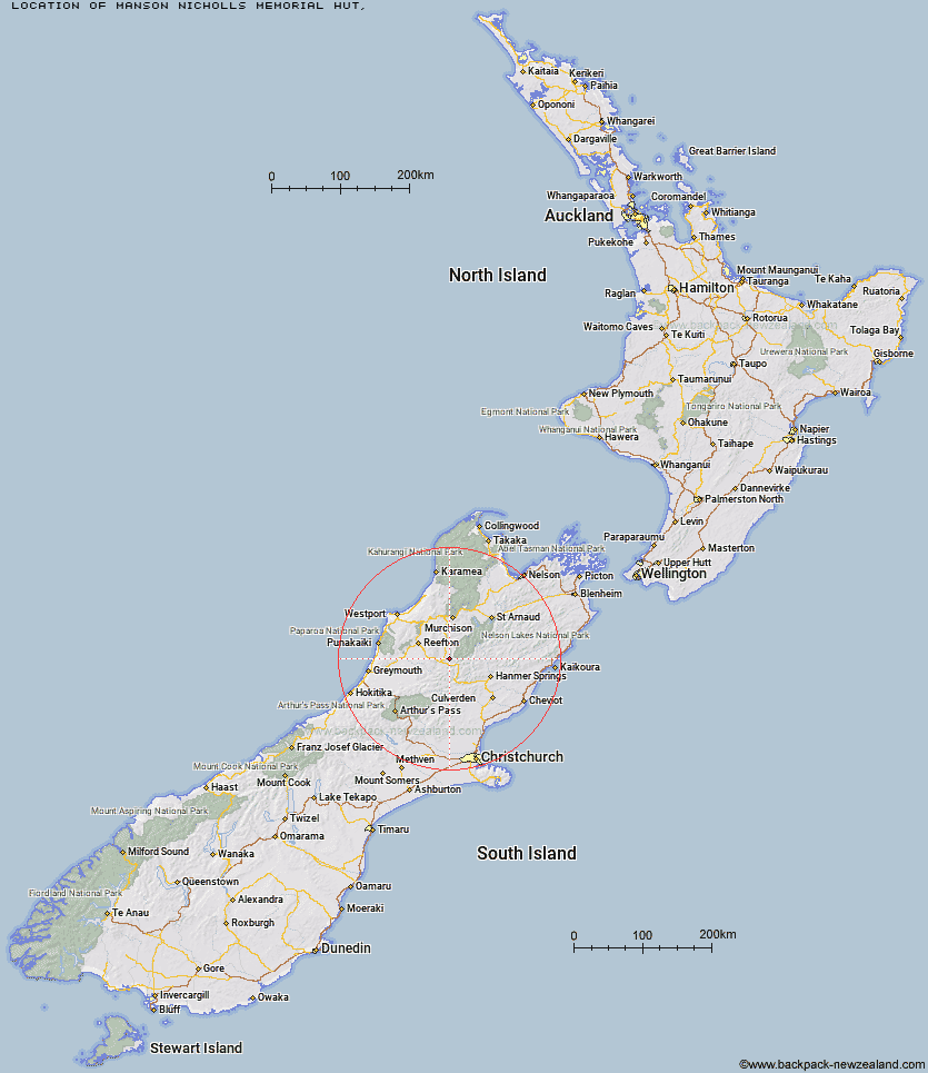
Topo Map showing location of Manson-Nicholls Memorial Hut
This information is sourced from DoC, LINZ and Openstreetmap. Some of the hut photos are mine and the rest are from DoC. I will be adding an upload feature soon so people can photos of .Manson-Nicholls Memorial Hut.
Latitude: -42.3049322872
Longitude: 172.289575797
Location:
Type of Hut:
Map: Topo Map | Road Map
Does this hut still exist? Have any more information? Contact
Latitude: -42.3049322872
Longitude: 172.289575797
Location:
Type of Hut:
Map: Topo Map | Road Map
Does this hut still exist? Have any more information? Contact
Scroll down to see a topographical map and road map showing the location of Manson-Nicholls Memorial Hut
[ A ] [ B ] [ C ] [ D ] [ E ] [ F ] [ G ] [ H ] [ I ] [ J ] [ K ] [ L ] [ M ] [ N ] [ O ] [ P ] [ Q ] [ R ] [ S ] [ T ] [ U ] [ V ] [ W ] [ Y ] [ Z ]
Closest 20 Huts to Manson-Nicholls Memorial Hut
These are as the crow fliesPell Stream Hut 4.56km Cannibal Gorge Hut 11.8km Brass Monkey Bivouac 12.91km Ada Pass Hut 13.79km Lucretia Hut 14.43km Lake Stream Hut 14.43km Lake Christabel Hut 14.97km Nina Hut 18.09km Upper Nina Bivouac 18.36km Bobs Hut 18.52km Top Waitahu Bivouac 18.66km Anne Cullers Hut 19.47km Rokeby Hut 20.23km Anne Hut 20.34km Devils Den Bivouac 20.34km Burn Creek Hut 21.08km Top Robinson Hut 21.28km Christopher Cullers Hut 22.19km Boyle Flat Hut 22.72km Christopher Hut 22.73km Doubtless Hut 24.7km Doubtful Hut 25.15km East Matakitaki Hut 25.32km Nardoo Hut 25.87km Magdalen Hut 26.25km Jervois Hut 26.71km Downie Hut 27.19km Mid Robinson Hut 27.43km Lake Man Bivouac 27.66km Pool Hut 28.64km Steyning Hut 28.64km Old Bridge Hut 28.97km Wheel Creek Hut 29.09km Tin Jug Hut 29.44km Lake Guyon Hut 29.59km Montgomerie Hut 29.62km Stanley Vale Hut 30.51km Slaty Creek Hut 31.56km Scotties Hut 31.96km Bus Shelter 32.01km