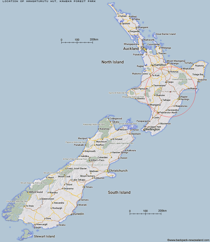
Topo Map showing location of Mangaturutu Hut
This information is sourced from DoC, LINZ and Openstreetmap. Some of the hut photos are mine and the rest are from DoC. I will be adding an upload feature soon so people can photos of .Mangaturutu Hut.
Basic info: Located in the central Kaweka Forest Park, Mangaturutu Hut is situated on a high altitudinal ridge connecting the Ngaruroro and Mohaka catchments.
Latitude: -39.219209782
Longitude: 176.329841956
Location: Kaweka Forest Park
Area: Hawke's Bay
Type of Hut: Standard
Map: BJ37 Topo Map | Road Map
Does this hut still exist? Have any more information? Contact
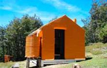
Image: DoC
Scroll down to see a topographical map and road map showing the location of Mangaturutu Hut
[ A ] [ B ] [ C ] [ D ] [ E ] [ F ] [ G ] [ H ] [ I ] [ J ] [ K ] [ L ] [ M ] [ N ] [ O ] [ P ] [ Q ] [ R ] [ S ] [ T ] [ U ] [ V ] [ W ] [ Y ] [ Z ]
Closest 20 Huts to Mangaturutu Hut
These are as the crow fliesVenison Tops Hut (Tira Lodge) 3.19km Ballard Hut 4.02km Omarukokere Bivouac 4.74km Te Puke (Te Pukeohikarua) Hut 5.41km Back Ridge Hut 6.81km Rocks Ahead Hut 6.89km Rocks Ahead Bivouac 6.95km Ngaawapurua Hut 7.16km Makino Hut 7.46km Back Ridge Bivouac 7.79km Harkness Hut 8.25km Middle Hill Hut 8.38km Dominie Hut 8.77km Mangatainoka Hut 8.85km Kaweka Flats Bivouac 8.87km Manson Bivouac 9.36km Studholme Saddle Hut 9.57km Iron Whare 9.61km Studholme Saddle Bivouac 10.03km Makahu Saddle Hut 10.08km Otutu Hut 10.3km Old Manson Hut 10.4km Manson Hut 10.47km Otutu Island Hut 11.47km Tussock Hut 11.53km Kiwi Mouth Hut 12.59km Kiwi Saddle Hut 12.67km Black Birch Bivouac 13.1km Te Matai Hut 13.3km Mackintosh Hut 13.61km Tevers Hut 13.95km Ernie's Creek Hut 14.84km East Creek Hut 14.85km Golden Hills Hut 14.93km Lower Ripia Hut 15.32km Upper Ripia Hut 15.49km Rock Camp Bivouac 15.64km Cameron Hut 16.18km Red Hut 16.32km Poronui Hut 16.93km