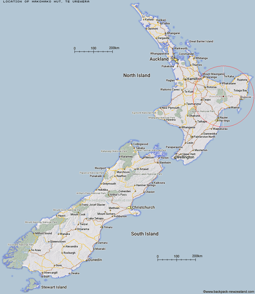
Topo Map showing location of Makomako Hut
This information is sourced from DoC, LINZ and Openstreetmap. Some of the hut photos are mine and the rest are from DoC. I will be adding an upload feature soon so people can photos of .Makomako Hut.
Basic info: standard eight-bunk hut in the Te Urewera area.
Latitude: -38.536290499
Longitude: 177.12867675
Location: Te Urewera
Area: East Coast
Type of Hut: Standard
Map: BG40 Topo Map | Road Map
Does this hut still exist? Have any more information? Contact
Basic info: standard eight-bunk hut in the Te Urewera area.
Latitude: -38.536290499
Longitude: 177.12867675
Location: Te Urewera
Area: East Coast
Type of Hut: Standard
Map: BG40 Topo Map | Road Map
Does this hut still exist? Have any more information? Contact
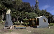
Image: DoC
Scroll down to see a topographical map and road map showing the location of Makomako Hut
[ A ] [ B ] [ C ] [ D ] [ E ] [ F ] [ G ] [ H ] [ I ] [ J ] [ K ] [ L ] [ M ] [ N ] [ O ] [ P ] [ Q ] [ R ] [ S ] [ T ] [ U ] [ V ] [ W ] [ Y ] [ Z ]
Closest 20 Huts to Makomako Hut
These are as the crow fliesMangatoatoa Hut 3.49km Taurawharona Hut 4.07km Te Rangaakapua Hut 6.78km Te Pua Hut 7.66km Waiawa Hut 7.76km Otanetea Hut 8.28km Te Panaa Hut 8.85km Otane Hut 10.96km Kanohirua Hut 11.71km Tataweka Hut 11.73km Takurua Hut 12.28km Makakoere Hut 12.28km Tawhiwhi Hut 12.4km Te Pourewa Hut 12.97km Manuoha Hut 13.34km Ngahiramai Hut 14.01km Kahunui Hut 14.35km Otapukawa Hut 16.09km Tawa Hut 16.31km Ohane Hut 17.33km Hanamahihi Hut 18.92km Sandy Bay Hut 19.02km Waikare Junction Hut 19.51km Whakatakaa Hut 20.58km Koranga Forks Hut 20.74km Whanganui Hut 21.91km Koaunui Hut 21.99km Manaohou Right Branch Hut 22.92km Onepu Hut 24.42km Waiharuru Hut 24.52km Nikau Flat Hut 24.55km Mangapouri Hut 25.83km Ohora Hut 26.51km Marauiti Hut 28.19km Kotepato Hut 28.4km Duckville Hut 29.08km Okui Hut 29.61km Horomanga Base Camp 29.73km Te Totara Hut 30.98km Casino Hut 31.26km