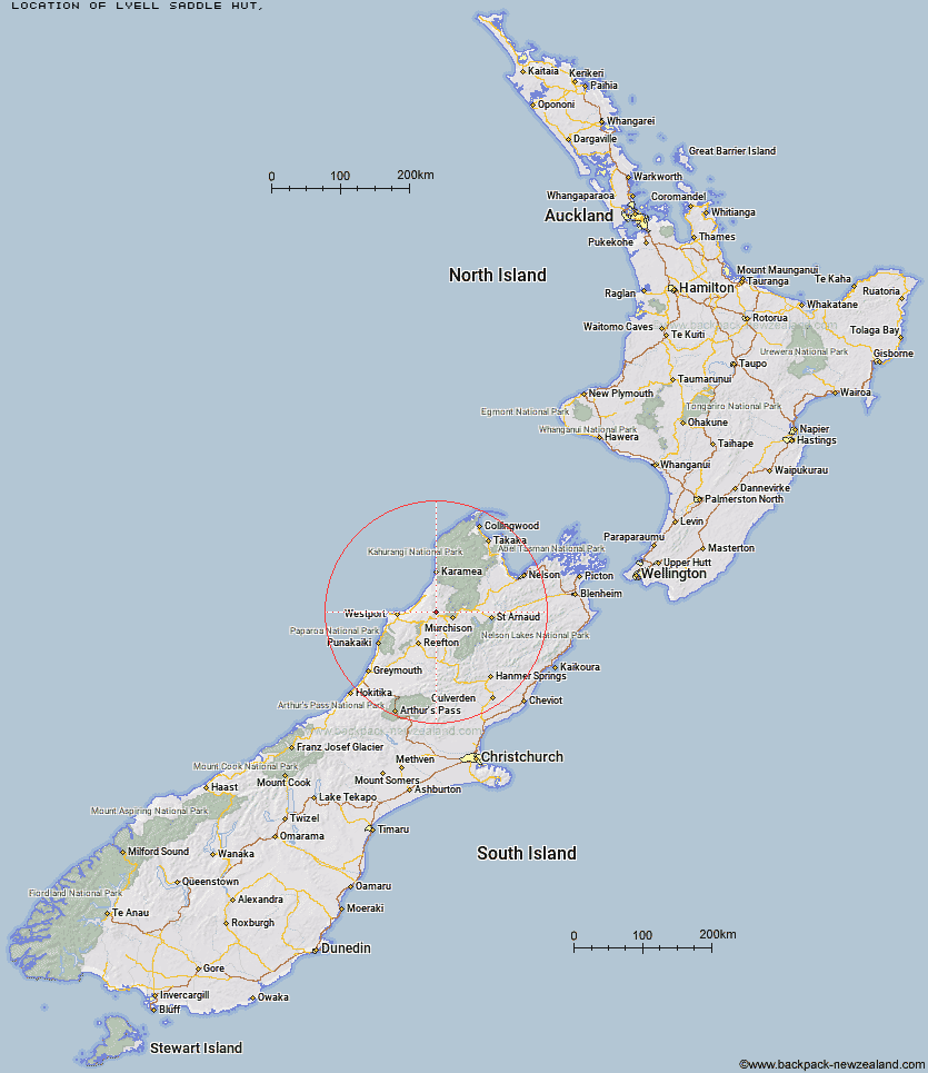
Topo Map showing location of Lyell Saddle Hut
This information is sourced from DoC, LINZ and Openstreetmap. Some of the hut photos are mine and the rest are from DoC. I will be adding an upload feature soon so people can photos of .Lyell Saddle Hut.
Latitude: -41.7238632334
Longitude: 172.099249765
Location:
Type of Hut:
Map: Topo Map | Road Map
Does this hut still exist? Have any more information? Contact
Latitude: -41.7238632334
Longitude: 172.099249765
Location:
Type of Hut:
Map: Topo Map | Road Map
Does this hut still exist? Have any more information? Contact
Scroll down to see a topographical map and road map showing the location of Lyell Saddle Hut
[ A ] [ B ] [ C ] [ D ] [ E ] [ F ] [ G ] [ H ] [ I ] [ J ] [ K ] [ L ] [ M ] [ N ] [ O ] [ P ] [ Q ] [ R ] [ S ] [ T ] [ U ] [ V ] [ W ] [ Y ] [ Z ]
Closest 20 Huts to Lyell Saddle Hut
These are as the crow fliesGhost Lake Hut 5.62km Stern Valley Hut 10.64km Goat Creek Hut 15.5km Specimen Point Hut 20.4km Lake Matiri Hut 20.61km Mokihinui Forks Hut 20.62km Poor Pete's Hut 22.18km Larrikin Creek Hut 25.63km McConchies Hut 26.74km Johnson Hut 32.09km Hurricane Hut 33.73km Wheel Creek Hut 38.68km Stag Flat Shelter 39.91km Taipo Hut 40.39km Helicopter Flat Hut 40.57km Branch Creek Hut 40.81km Wangapeka Bivouac 41.02km Buckland Peaks Hut 42.42km Cecil Kings Hut 42.6km Kirwans Hut 42.82km Kings Creek Hut 42.83km Belltown Manunui Hut 43.15km Trevor Carter Hut 43.57km Stone Hut 44.02km Granity Pass Hut 44.42km Tiraumea Hut 44.92km Kākāpō Hut 46.73km Mole Hut 47.24km Matakitaki Base Hut 47.58km Montgomerie Hut 48.08km Kiwi Saddle Hut 48.19km D'Urville Hut 49.63km Nardoo Hut 49.71km Thor Hut 49.95km John Reid Hut 51.8km Sabine Hut 52.11km Morgan Hut 52.6km Mount Misery Hut 52.8km Venus Hut 53.39km Top Waitahu Bivouac 53.44km