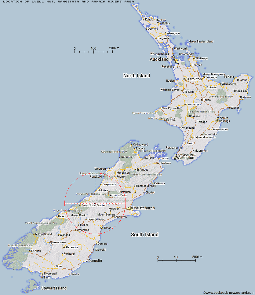
Topo Map showing location of Lyell Hut
This information is sourced from DoC, LINZ and Openstreetmap. Some of the hut photos are mine and the rest are from DoC. I will be adding an upload feature soon so people can photos of .Lyell Hut.
Basic info: basic six-bunk hut in the Mid and South Canterbury area.
Latitude: -43.2991152342
Longitude: 170.909683446
Location: Rangitata and Rakaia Rivers area
Area: Canterbury
Type of Hut: Basic/bivvies
Map: BW18 Topo Map | Road Map
Does this hut still exist? Have any more information? Contact
Basic info: basic six-bunk hut in the Mid and South Canterbury area.
Latitude: -43.2991152342
Longitude: 170.909683446
Location: Rangitata and Rakaia Rivers area
Area: Canterbury
Type of Hut: Basic/bivvies
Map: BW18 Topo Map | Road Map
Does this hut still exist? Have any more information? Contact
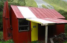
Image: DoC
Scroll down to see a topographical map and road map showing the location of Lyell Hut
[ A ] [ B ] [ C ] [ D ] [ E ] [ F ] [ G ] [ H ] [ I ] [ J ] [ K ] [ L ] [ M ] [ N ] [ O ] [ P ] [ Q ] [ R ] [ S ] [ T ] [ U ] [ V ] [ W ] [ Y ] [ Z ]
Closest 20 Huts to Lyell Hut
These are as the crow fliesReischek Hut 4.9km Lauper Bivouac 5.63km Lawrence Bivouac 5.64km Washbourne Hut 9.3km Evans Hut 10.75km Smyth Hut 11.17km Hermitage Hut 11.4km Cameron Hut 11.57km Banfield Hut 11.84km Lawrence Hut 13.72km McCoy Hut 13.97km Thompsons Hut 14.42km Neave Hut 14.44km Hunters Hut 15.09km Watchdog Hut 15.6km County Stream Hut 16.4km Top Hut 16.61km Jellicoe Hut 16.73km Wilkinson Hut 17.11km Erewhon Station Hut 17.2km Downs Hut 17.77km Ivory Lake Hut 18.21km Highland Home 18.45km Top Waitaha Hut 18.84km Price Basin Hut 19.2km Moonbeam Hut 19.49km West Mathias Bivouac 20.73km Scamper Torrent Hut 21.35km Centennial Cabin 21.78km Mathias Hut 21.85km Potts Hut 21.9km Price Flat Hut 22.46km Kiwi Flat Hut 22.5km Saint Winifreds Hut 22.53km Price Flat Hut 22.59km Moraine Hut 23.02km Curtis Memorial Hut 23.34km Top Tuke Hut 23.34km Charlies Hut 23.44km Mistake Flats Hut 24.08km