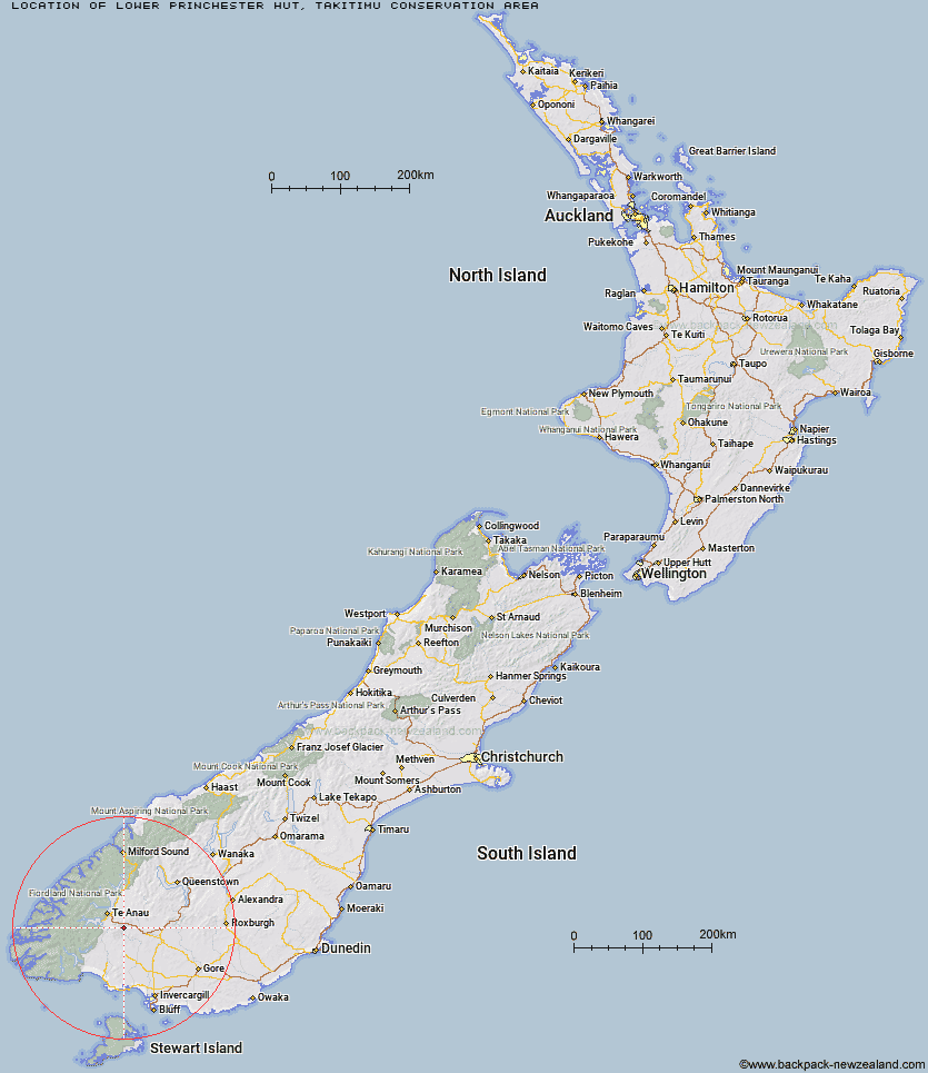
Topo Map showing location of Lower Princhester Hut
This information is sourced from DoC, LINZ and Openstreetmap. Some of the hut photos are mine and the rest are from DoC. I will be adding an upload feature soon so people can photos of .Lower Princhester Hut.
Basic info: standard six-bunk hut in the Southland area.
Latitude: -45.593597515
Longitude: 167.95145852
Location: Takitimu Conservation Area
Area: Southland
Type of Hut: Standard
Tracks: Takitimu Mountains tracks and routes
Map: CD08 Topo Map | Road Map
Does this hut still exist? Have any more information? Contact
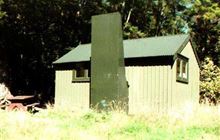
Image: DoC
Scroll down to see a topographical map and road map showing the location of Lower Princhester Hut
[ A ] [ B ] [ C ] [ D ] [ E ] [ F ] [ G ] [ H ] [ I ] [ J ] [ K ] [ L ] [ M ] [ N ] [ O ] [ P ] [ Q ] [ R ] [ S ] [ T ] [ U ] [ V ] [ W ] [ Y ] [ Z ]
Closest 20 Huts to Lower Princhester Hut
These are as the crow fliesUpper Princhester Hut 4.33km Becketts Hut 7.94km Aparima Forks Hut 8.8km Whare Creek Hut 12.78km Aparima Huts 13.17km Cheviot Downs Hut 13.59km Spence Hut 13.66km Upper Wairaki Hut 16.44km Redcliff Hut 17.14km Oreti Hut 18.47km Telford Hut 19.45km Lower Wairaki Hut 20.69km Lower Windley Hut 21.35km Rock Hut 27.55km Shallow Bay Hut 28.65km Kiwi Burn Hut 28.66km Upper Windley Hut 28.72km Back Valley Hut 28.79km Moturau Hut 29.31km Lincoln Hut 29.64km Islands Hut 29.82km Brod Bay Shelter and Campsite 30.12km Barcoo Hut 30.34km Hope Arm Hut 31.91km Upper Oreti Hut 31.93km Cromel Base Hut 31.94km Upper Cromel Hut 33.59km Mt Bee Bunkrooms 33.65km Ashton Hut 33.95km Cromel Branch Hut 34.52km Luxmore Hut 34.75km Forest Burn Shelter 37.29km Irthing Hut 37.47km North Borland Hut 37.61km Army Hut 37.76km Mansion Hut 38.26km Hanging Valley Shelter 39.97km Iris Burn Hut 40.68km Shepherd Creek Hut 42.96km Dog Box Bivouac 43.25km