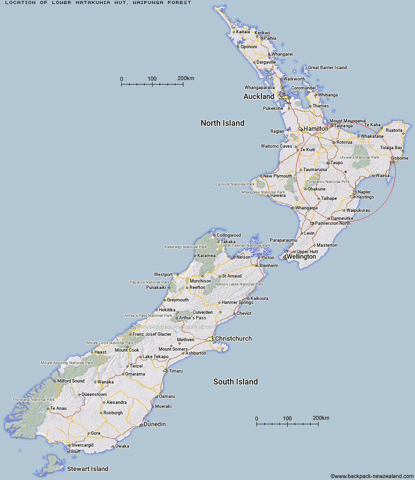
Topo Map showing location of Lower Matakuhia Hut
This information is sourced from DoC, LINZ and Openstreetmap. Some of the hut photos are mine and the rest are from DoC. I will be adding an upload feature soon so people can photos of .Lower Matakuhia Hut.
Basic info: basic six-bunk hut in the Te Urewera area.
Latitude: -38.9341116848
Longitude: 176.598827869
Location: Waipunga Forest
Area: East Coast
Type of Hut: Basic/bivvies
Map: BH38 Topo Map | Road Map
Does this hut still exist? Have any more information? Contact
Basic info: basic six-bunk hut in the Te Urewera area.
Latitude: -38.9341116848
Longitude: 176.598827869
Location: Waipunga Forest
Area: East Coast
Type of Hut: Basic/bivvies
Map: BH38 Topo Map | Road Map
Does this hut still exist? Have any more information? Contact
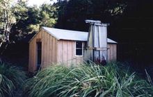
Image: DoC
Scroll down to see a topographical map and road map showing the location of Lower Matakuhia Hut
[ A ] [ B ] [ C ] [ D ] [ E ] [ F ] [ G ] [ H ] [ I ] [ J ] [ K ] [ L ] [ M ] [ N ] [ O ] [ P ] [ Q ] [ R ] [ S ] [ T ] [ U ] [ V ] [ W ] [ Y ] [ Z ]
Closest 20 Huts to Lower Matakuhia Hut
These are as the crow fliesHalfway Hut 3.35km Upper Matakuhia Hut 4.45km Lower Ohane Hut 11.81km Upper Te Hoe Hut 14.84km Upper Whirinaki Hut 14.96km Central Te Hoe Hut 16.32km Upper Toropapa Hut 18.54km Central Whirinaki Hut 18.76km Mangakahika Hut 20.68km Mangamate Hut 21.31km Moerangi Hut 23.36km Upper Ripia Hut 23.84km Lower Ripia Hut 24.63km Vern's Camp Shelter 24.63km Ernie's Creek Hut 24.65km Tevers Hut 25.62km Galbraith Hut 26.03km Te Matai Hut 26.03km Rogers Hut (Te Wairoa) 26.05km Te Waiotukapiti Hut 26.18km Central Waiau Hut 28.33km Skips Hut (Whangatawhia) 29.46km Red Hut 29.98km East Creek Hut 31.61km Poronui Hut 31.63km Te Totara Hut 32.8km Makino Hut 32.86km Oamaru Hut 32.87km Mangatainoka Hut 35.29km Middle Hill Hut 35.83km Waiopaoa Hut 36.93km Iron Whare 38.65km Marauiti Hut 39.05km Ballard Hut 39.15km Mangaturutu Hut 39.3km Kaweka Flats Bivouac 39.72km Te Puke (Te Pukeohikarua) Hut 40.07km Panekire Hut 41.48km Tussock Hut 41.94km Venison Tops Hut (Tira Lodge) 42.23km