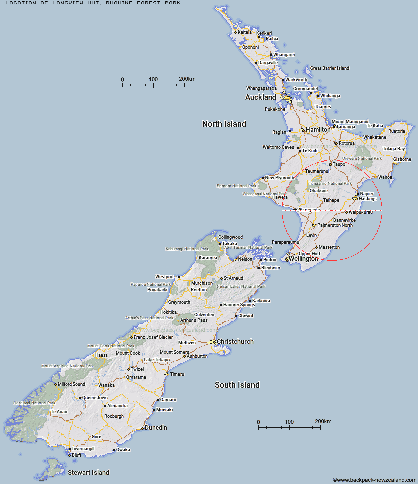
Topo Map showing location of Longview Hut
This information is sourced from DoC, LINZ and Openstreetmap. Some of the hut photos are mine and the rest are from DoC. I will be adding an upload feature soon so people can photos of .Longview Hut.
Basic info: serviced 12-bunk hut in the Hawke's Bay region.
Latitude: -39.9513706853
Longitude: 176.122330237
Location: Ruahine Forest Park
Area: Hawke's Bay
Type of Hut: Serviced
Tracks: Kashmir Road tramping tracks|Table Flat - Kashmir Roadend West-East crossing
Map: BL36 Topo Map | Road Map
Does this hut still exist? Have any more information? Contact
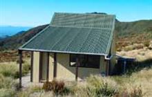
Image: DoC
Scroll down to see a topographical map and road map showing the location of Longview Hut
[ A ] [ B ] [ C ] [ D ] [ E ] [ F ] [ G ] [ H ] [ I ] [ J ] [ K ] [ L ] [ M ] [ N ] [ O ] [ P ] [ Q ] [ R ] [ S ] [ T ] [ U ] [ V ] [ W ] [ Y ] [ Z ]
Closest 20 Huts to Longview Hut
These are as the crow fliesTop Gorge Hut 2.33km Awatere Hut 2.58km Daphne Hut 4.64km Howletts Hut 5.24km Happy Daze Hut 5.35km Toka Bivouac 5.53km Makaretu Hut 5.78km Iron Gate Hut 6.19km Triangle Hut 6.57km Leon Kinvig Hut 7.07km Tarn Bivouac 7.76km Alice Nash Memorial Heritage Lodge 8.94km Hinerua Hut 10.75km Pourangaki Hut 10.9km Ngamoko Hut 11.05km Rangiwahia Hut 11.13km Smiths Stream Hut 12.08km Kelly Knight Hut 12.71km Piripiri Hut 13.26km Mid Pohangina Hut 13.61km Waterfall Hut 13.63km Cattle Creek Hut 13.68km Waikamaka Hut 15.57km Purity Hut 15.63km Stanfield Hut 16.45km Waipawa Forks Hut 17.56km Sunrise Hut 18.64km Triplex Hut 18.72km McKinnon Hut 19.02km Traverse (A Frame) Hut 19.62km Top Maropea Hut 19.91km Crow Hut 20.75km Diggers Hut 21.85km Wakelings Hut 21.89km Gold Creek Hut 22.02km Kawhatau Base 22.32km Norris Hut 22.6km Forks Hut 23.82km Sparrowhawk Bivouac 24.22km Te Ekaou Hut 24.25km