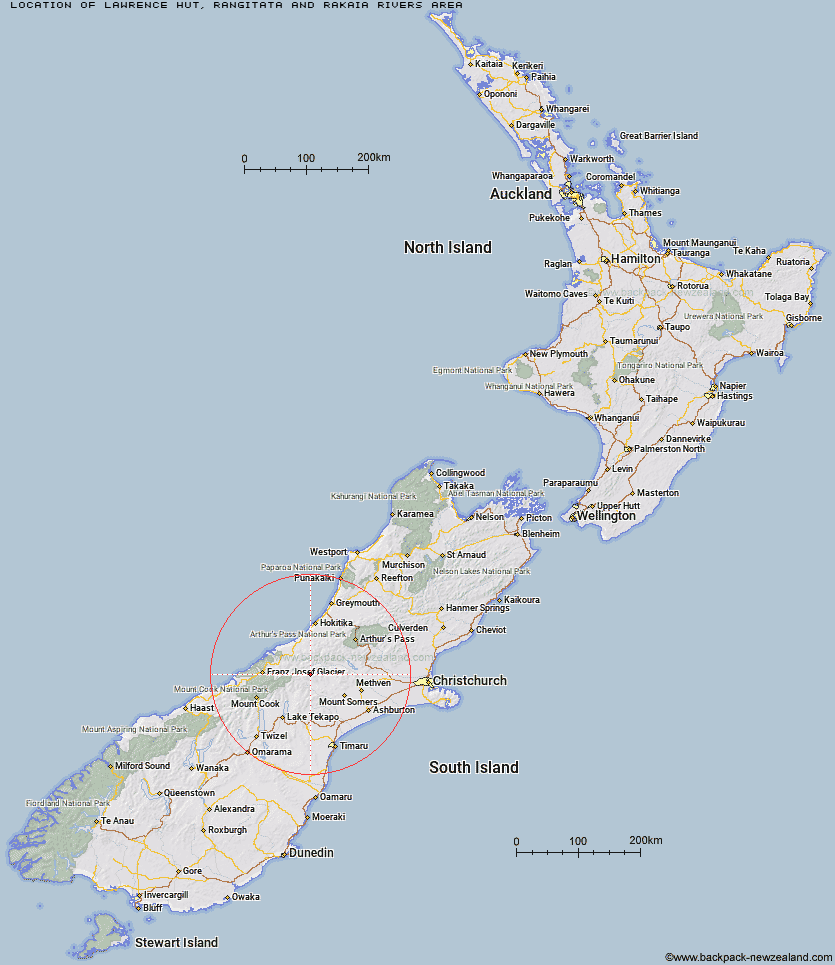
Topo Map showing location of Lawrence Hut
This information is sourced from DoC, LINZ and Openstreetmap. Some of the hut photos are mine and the rest are from DoC. I will be adding an upload feature soon so people can photos of .Lawrence Hut.
Basic info: standard six-bunk hut in the Mid and South Canterbury area.
Latitude: -43.4212121369
Longitude: 170.884963055
Location: Rangitata and Rakaia Rivers area
Area: Canterbury
Type of Hut: Standard
Map: BX18 Topo Map | Road Map
Does this hut still exist? Have any more information? Contact
Basic info: standard six-bunk hut in the Mid and South Canterbury area.
Latitude: -43.4212121369
Longitude: 170.884963055
Location: Rangitata and Rakaia Rivers area
Area: Canterbury
Type of Hut: Standard
Map: BX18 Topo Map | Road Map
Does this hut still exist? Have any more information? Contact
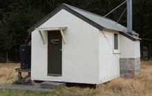
Image: DoC
Scroll down to see a topographical map and road map showing the location of Lawrence Hut
[ A ] [ B ] [ C ] [ D ] [ E ] [ F ] [ G ] [ H ] [ I ] [ J ] [ K ] [ L ] [ M ] [ N ] [ O ] [ P ] [ Q ] [ R ] [ S ] [ T ] [ U ] [ V ] [ W ] [ Y ] [ Z ]
Closest 20 Huts to Lawrence Hut
These are as the crow fliesHermitage Hut 2.87km Erewhon Station Hut 4.12km Watchdog Hut 7.93km Lawrence Bivouac 8.47km McCoy Hut 10.04km Potts Hut 10.4km Top Hut 11.62km Cameron Hut 12.32km Lyell Hut 13.72km Black Mountain Hut 14.19km Curtis Memorial Hut 14.36km Highland Home 15.19km Growler Hut 15.45km Mistake Flats Hut 15.74km Saint Winifreds Hut 16.31km Reischek Hut 16.97km Murphys Bivvy 17.54km Lauper Bivouac 18.17km Dog Kennel Bivouac 19.07km Boundary Creek Hut 19.27km Banfield Hut 19.43km Washbourne Hut 19.5km Forbes Bivouac 19.73km Carneys Bivvy's 19.8km Thompsons Hut 20.56km Evans Hut 21.49km Downs Hut 21.71km Smyth Hut 23.78km Crooked Spur Hut 23.81km Charlies Hut 23.96km Hunters Hut 24.16km Jellicoe Hut 24.26km Scone Hut 26.01km Neave Hut 27.9km Macaulay Hut 28.8km County Stream Hut 29.39km Wilkinson Hut 30.61km Stone Hut 30.88km Godley Hut 30.94km Double Hut 31.44km