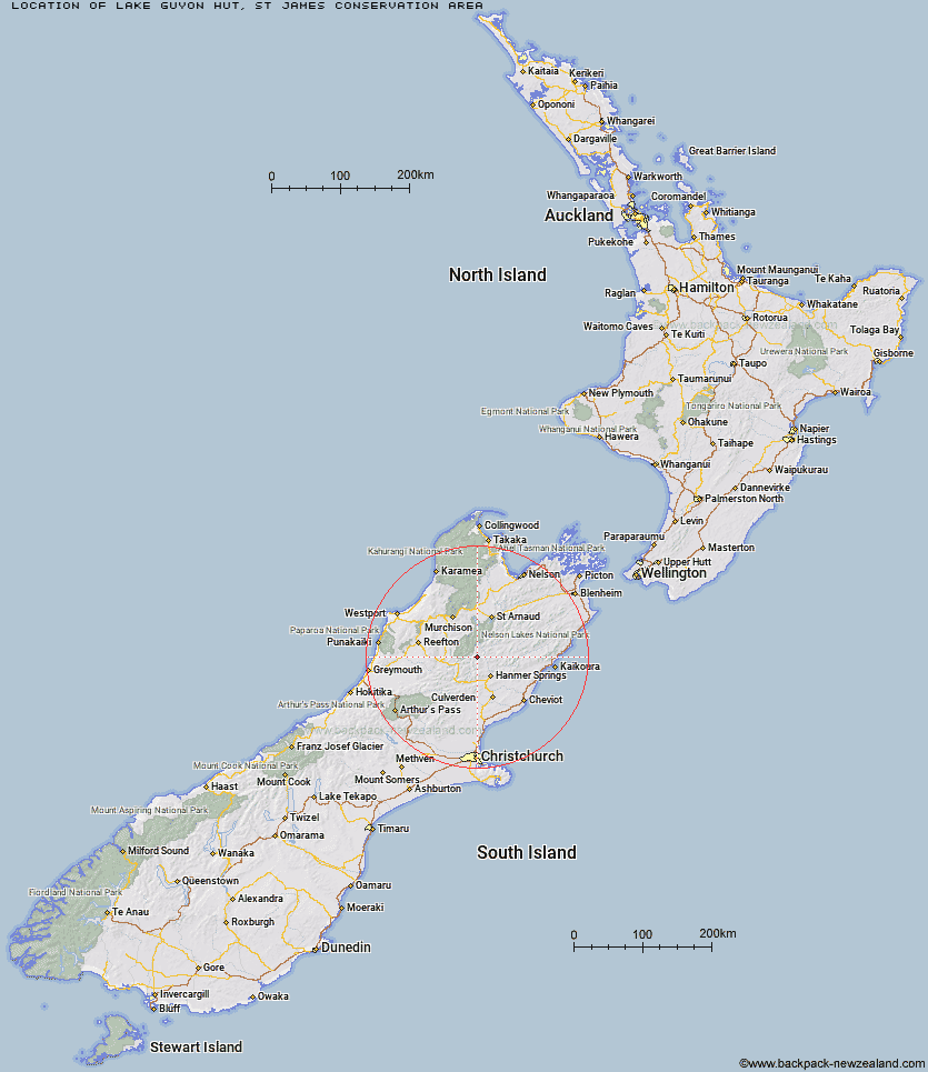
Topo Map showing location of Lake Guyon Hut
This information is sourced from DoC, LINZ and Openstreetmap. Some of the hut photos are mine and the rest are from DoC. I will be adding an upload feature soon so people can photos of .Lake Guyon Hut.
Basic info: standard four-bunk hut in St James Conservation Area.
Latitude: -42.2870859752
Longitude: 172.648511523
Location: St James Conservation Area
Area: Canterbury
Type of Hut: Standard
Tracks: Fowlers Pass Track|St James Cycle Trail
Map: BS3 Topo Map | Road Map
Does this hut still exist? Have any more information? Contact
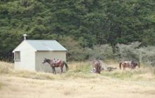
Image: DoC
Scroll down to see a topographical map and road map showing the location of Lake Guyon Hut
[ A ] [ B ] [ C ] [ D ] [ E ] [ F ] [ G ] [ H ] [ I ] [ J ] [ K ] [ L ] [ M ] [ N ] [ O ] [ P ] [ Q ] [ R ] [ S ] [ T ] [ U ] [ V ] [ W ] [ Y ] [ Z ]
Closest 20 Huts to Lake Guyon Hut
These are as the crow fliesStanley Vale Hut 3.37km Christopher Hut 6.87km Christopher Cullers Hut 7.48km Fowlers Hut 10.01km Anne Hut 12.14km Pool Hut 12.4km Old Bridge Hut 12.66km East Matakitaki Hut 12.8km Anne Cullers Hut 13.25km Caroline Creek Bivouac 14.88km Bobs Hut 15.11km Jervois Hut 15.41km Ada Pass Hut 15.84km Scotties Hut 15.88km Cannibal Gorge Hut 18.5km Stony Stream Bivouac 19.69km Downie Hut 19.91km Upper D'Urville Hut 20.19km Tin Jug Hut 20.79km Paske Hut 21.38km Island Gully Hut 21.42km Steyning Hut 21.58km Burn Creek Hut 21.9km Rokeby Hut 22.29km Boyle Flat Hut 25.14km Blue Lake Hut 25.45km Pell Stream Hut 25.88km Sedgemere Sleepout 26.7km George Lyon Hut 26.88km Magdalen Hut 27.38km Nardoo Hut 27.76km Yarra Hut 28.64km Lucretia Hut 29.15km Tutu Hut 29.48km Manson-Nicholls Memorial Hut 29.59km Begley Hut 30.75km Upper Travers Hut 30.81km Brass Monkey Bivouac 31.03km West Sabine Hut 31.18km Carlyle Hut 31.84km