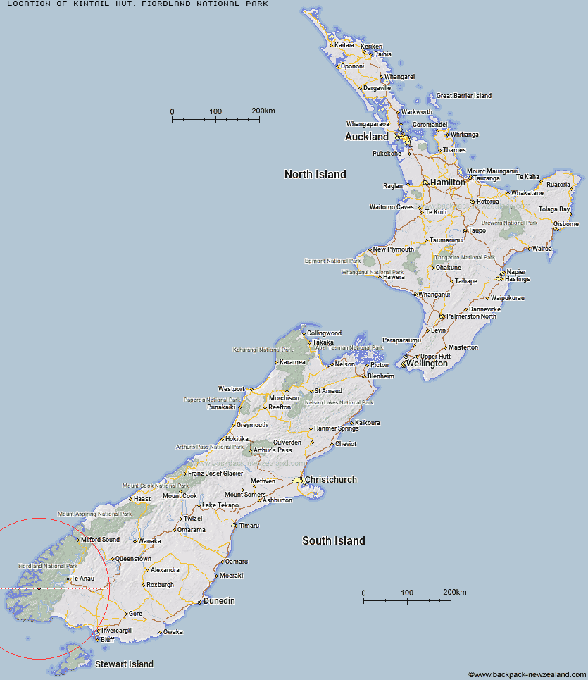
Topo Map showing location of Kintail Hut
This information is sourced from DoC, LINZ and Openstreetmap. Some of the hut photos are mine and the rest are from DoC. I will be adding an upload feature soon so people can photos of .Kintail Hut.
Basic info: standard 12-bunk hut in western Fiordland.
Latitude: -45.6146578148
Longitude: 167.115836885
Location: Fiordland National Park
Area: Fiordland
Type of Hut: Standard
Tracks: Dusky Track
Map: CE06 Topo Map | Road Map
Does this hut still exist? Have any more information? Contact
Basic info: standard 12-bunk hut in western Fiordland.
Latitude: -45.6146578148
Longitude: 167.115836885
Location: Fiordland National Park
Area: Fiordland
Type of Hut: Standard
Tracks: Dusky Track
Map: CE06 Topo Map | Road Map
Does this hut still exist? Have any more information? Contact
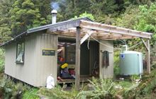
Image: DoC
Scroll down to see a topographical map and road map showing the location of Kintail Hut
[ A ] [ B ] [ C ] [ D ] [ E ] [ F ] [ G ] [ H ] [ I ] [ J ] [ K ] [ L ] [ M ] [ N ] [ O ] [ P ] [ Q ] [ R ] [ S ] [ T ] [ U ] [ V ] [ W ] [ Y ] [ Z ]
Closest 20 Huts to Kintail Hut
These are as the crow fliesKintail Hut 0km Upper Spey Hut 5.31km Loch Maree Hut 8.73km Lake Roe Hut 10.12km West Arm Hut 15.16km Halfway Hut 16.28km Percy Shelter 16.41km Supper Cove Hut 16.49km Hauroko Burn Hut 24.13km Borland Bivouac 24.25km Historic Clark Hut 24.59km Clark Hut - A Frame 25.9km Freeman Burn Hut 28.33km Green Lake Hut 29.12km North Borland Hut 29.85km Monowai Hut 30.42km Hope Arm Hut 33.22km Eel Creek Hut 35.34km Back Valley Hut 36.26km Rodger Inlet Huts 37.07km The Gut Hut 37.6km Caroline Hut 38.58km Iris Burn Hut 38.93km Shallow Bay Hut 40.96km Moturau Hut 41.27km Hanging Valley Shelter 41.69km Forest Burn Shelter 43.47km Luxmore Hut 46.79km Stantley Burn Hut 47.35km Deas Cove Hut 48.15km Brod Bay Shelter and Campsite 49.4km Rocky Point Hut 49.75km Robin Saddle Hut 50.09km Cheviot Downs Hut 52.12km Teal Bay Hut 52.13km Lake Poteriteri Hut 55.25km Whare Creek Hut 55.54km Redcliff Hut 56.51km Telford Hut 58.75km Junction Burn Hut 59.58km